Area Overview for PL2 2BE
Photos of PL2 2BE
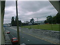
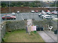
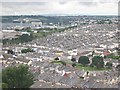
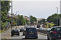
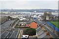
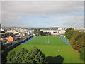
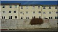
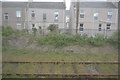

97 photos from this area
Area Information
Key information about the PL2 2BE including its size, population, and administrative classification.
- Area Type
- Postcode
- Area Size
- 1.4 hectares
- Population
- 1047
- Population Density
- 2774 people/km²
House Prices in PL2 2BE
46
Properties
£111,495
Average Sold Price
£36,500
Lowest Price
£270,000
Highest Price
Showing 46 properties
| Address | Type | Beds | Baths | Last Sale Price | Last Sale Date | |
|---|---|---|---|---|---|---|
| 162A Saltash Road, Keyham, Plymouth, PL2 2BE | Flat | 2 | 1 | £60,000 | Aug 2023 | |
| 138 Saltash Road, Keyham, Plymouth, PL2 2BE | Terraced | 4 | 2 | £270,000 | Aug 2023 | |
| 132 Saltash Road, Keyham, Plymouth, PL2 2BE | Terraced | 3 | - | £195,000 | May 2022 | |
| 136 Saltash Road, Keyham, Plymouth, PL2 2BE | Flat | 1 | 1 | £92,500 | Jul 2021 | |
| 146 SALTASH ROAD, Keyham, Plymouth, PL2 2BE | Flat | 5 | 3 | £110,000 | Mar 2017 | |
| 140 Saltash Road, Keyham, Plymouth, PL2 2BE | house | 3 | - | £123,500 | Jan 2012 | |
| 134 Saltash Road, Keyham, Plymouth, PL2 2BE | house | 3 | - | £104,950 | Jun 2010 | |
| 162 Saltash Road, Keyham, Plymouth, PL2 2BE | Maisonette | 3 | 2 | £71,500 | Sep 2002 | |
| 142 Saltash Road, Keyham, Plymouth, PL2 2BE | house | - | - | £51,000 | Jul 2001 | |
| 130 Saltash Road, Keyham, Plymouth, PL2 2BE | house | - | - | £36,500 | Aug 1998 |
Page 1 of 5
Energy Efficiency in PL2 2BE
Amenities
Schools
| Rank | School | Type | Entry gender | Ages |
|---|
Explore more schools in this area
Go to Schools tabDemographics
Household Size
Two person
most common
Accommodation Type
Houses
most common
Tenure
56
majority
Ethnic Group
White
most common
Religion
N/A
most common
Household Composition
N/A
most common
Age
47
median
Adults (30-64 years)
most common
Household Deprivation
N/A
with no deprivation
NS-SEC
22
in Lower managerial occupations
Explore more demographic insights in this area
Go to Demographics tabPlanning
Planning Constraints
- Flood RiskPremium
- Ramsar Wetland SitesPremium
- Area of Outstanding Natural BeautyPremium
- Protected Nature ReservePremium
- Protected WoodlandPremium