Area Overview for PL19 9EE
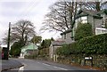
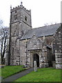
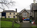
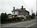
Photos of PL19 9EE


Area Information
Living in PL19 9EE offers a specific residential experience characterised by high density within a compact footprint. This postcode covers a small cluster containing a total population of 2,342 people spread across just 2,226 square metres. The resulting population density reaches 2,298 people per square kilometre, creating an environment where neighbours are close by. You will find yourself in a tightly integrated community where daily life revolves around immediate surroundings rather than extensive travel. The area functions as a distinct residential cluster rather than a sprawling neighbourhood, meaning your local interactions are frequent and your daily needs are located literally on your doorstep. For a prospective buyer, the scale of this area means you are looking at a contained community with defined boundaries. The high density suggests a bustling atmosphere where services and amenities are concentrated efficiently. You do not have to look far for entertainment or shopping, as the infrastructure supports a large number of residents within a very small physical space. This layout is ideal for those who prefer a neighbourhood feel over urban isolation or suburban sprawl. The compact nature of PL19 9EE ensures that the rhythm of daily life is fast-paced and convenient, with everything accessible without needing a vehicle for short trips.
- Area Type
- Postcode
- Area Size
- 2226 m²
- Population
- 2342
- Population Density
- 2298 people/km²
The property market in PL19 9EE is heavily skewed towards owner-occupiers, with 68 per cent of households owning their homes outright or with a mortgage. This high ownership figure indicates a stable market where residents have a vested interest in maintaining and improving their properties. The accommodation type is exclusively houses, meaning you will not find flats, bungalows, or purpose-built retirement homes within this specific postcode boundary. Every home available for purchase or rent in PL19 9EE is a standalone house, which influences the types of buyers attracted to the area. This homogeneity in housing types limits the variety of property options compared to mixed-use areas. If you are looking for a semi-detached, detached, or terraced house, you have selections here, but you cannot expect to find apartments or townhouses. The fact that the area is entirely composed of houses supports the high home ownership rate. First-time buyers might find the market challenging if they require lower-price-entry flats, as these property types do not exist within PL19 9EE. Instead, the market caters to those seeking traditional family homes or larger single-family residences. Buyers looking for investment properties in high-density rental blocks will find nothing here, as the entire stock comprises houses suited for owner-occupiers or small-sector landlords.
House Prices in PL19 9EE
Showing 6 properties
| Address | Type | Beds | Baths | Last Sale Price | Last Sale Date | |
|---|---|---|---|---|---|---|
| 5, West View, Anderton Court, Whitchurch, PL19 9EE | Semi-detached | 3 | 2 | £272,500 | Jul 2024 | |
| 1, West View, Anderton Court, Whitchurch, PL19 9EE | house | - | - | £257,000 | Jul 2021 | |
| 6, West View, Anderton Court, Whitchurch, PL19 9EE | Semi-detached | - | - | £187,500 | Aug 2007 | |
| 3, West View, Anderton Court, Whitchurch, PL19 9EE | Semi-detached | - | - | - | - | |
| 2, West View, Anderton Court, Whitchurch, PL19 9EE | house | - | - | - | - | |
| 4, West View, Anderton Court, Whitchurch, PL19 9EE | house | - | - | - | - |
Energy Efficiency in PL19 9EE
Daily life in PL19 9EE is supported by a practical range of amenities located within practical reach for all residents. For shopping needs, you can visit the Spar Whitchurch for groceries and essentials. Those requiring larger supermarket stocks have access to Lidl Tavistock and Tesco Tavistock, both of which are noted as nearby essentials. These five retail venues provide the necessary variety for weekly shopping and daily necessities. Beyond food, the area is surrounded by four railway stations within a convenient distance: Gunnislake Railway Station, Calstock Railway Station, and Bere Alston Railway Station. The proximity to these three rail links offers direct train connections to broader Devon and Cornwall networks. You can commute into work or travel for leisure with multiple station options nearby. The combination of supermarkets and rail stations creates a self-contained lifestyle where you do not need a private car for every journey. Living in PL19 9EE means having your food shopping and rail travel options integrated into your immediate neighbourhood radius. This connectivity reduces reliance on public transport buses for some journeys and offers flexibility for commuters. The availability of major supermarkets and train stations ensures that your day-to-day routine remains efficient and accessible.
Amenities
Schools
For families considering homes in PL19 9EE, education is a straightforward matter due to the limited options in the immediate vicinity. The primary choice is Whitchurch Community Primary School, which serves as the sole primary institution listed for the area. This school holds a good Ofsted rating, indicating it meets required standards for education and care. With no secondary schools listed in the direct data for this tiny postcode, older children may need to travel beyond PL19 9EE for their secondary education. The presence of only one primary school means there is less competition for places at the infant level, but you should anticipate potential transport logistics during term time drop-off and collection. Whitchurch Community Primary School is the key educational anchor for residents in this postcode. If you live on the edge of the area, you might need to verify catchment boundaries with the school or the local council to ensure your child receives a place at the intended school. The good rating provides reassurance regarding the quality of instruction your children will receive locally. While options are limited to this single primary entity, the rating suggests a competent and regulated environment for young learners.
| Rank | School | Type | Entry gender | Ages |
|---|
Explore more schools in this area
Go to Schools tabDemographics
The people calling PL19 9EE home form a mature and established community. The median age is 47 years, indicating that the core demographic consists of adults between the ages of 30 and 64. This age profile suggests a population that has settled down, likely comprising families with older children, empty nesters, or retired couples. With 68 per cent of residents owning their homes, the area is predominantly owner-occupied, reflecting long-term stability and investment in the locality. Over two-thirds of households are tied to the property through ownership rather than renting, which often correlates with a desire for permanence. Accommodation in this postcode consists entirely of houses, with no flats or purpose-built rental blocks reported in the available data. This housing stock aligns with the home ownership statistics and the mature age profile. The predominant ethnic group is White, mirroring the broader national demographic trends for this region of the UK. The community is relatively homogenous, with the majority of residents sharing similar cultural backgrounds. You are looking at an area where long-term residents have shaped the character of the neighbourhood. The high home ownership rate and the specific age range create a stable environment where noise, pet ownership, and community rules are likely well-established and respected by the majority.
Household Size
Accommodation Type
Tenure
Ethnic Group
Religion
Household Composition
Age
Household Deprivation
NS-SEC
Explore more demographic insights in this area
Go to Demographics tabPlanning
Planning Constraints
- Flood RiskPremium
- Ramsar Wetland SitesPremium
- Area of Outstanding Natural BeautyPremium
- Protected Nature ReservePremium
- Protected WoodlandPremium