Area Overview for PL19 8XZ
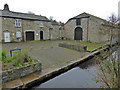
Photos of PL19 8XZ


Area Information
Living in PL19 8XZ means residing within a small residential cluster defined by the postcode PL19 8XZ. This specific area contains a population of 1,966 residents, creating a close-knit environment where neighbours are likely to know one another. The settlement sits at a population density of 1,035 people per square kilometre, indicating a mix of open space and habitation typical of the Cornwall outskirts. Daily life here revolves around the needs of this local community, situated away from the busiest urban centres yet connected by road and rail. Prospective buyers should note that PL19 8XZ is not a vast municipality but a focused residential zone where convenience relies heavily on proximity to nearby hubs like Tavistock. The area offers a distinct character shaped by its modest size and specific demographic profile. Homebuyers looking for a defined neighbourhood rather than a sprawling borough will find PL19 8XZ provides a clear, contained living environment. Understanding the scale of this postcode is essential before viewing homes, as the local services and transport links are calibrated for this specific population size and distribution.
- Area Type
- Postcode
- Area Size
- Not available
- Population
- 1966
- Population Density
- 1035 people/km²
The housing landscape in PL19 8XZ is defined by high ownership rates and a lack of rental stock. With 65% of residents owning their homes, this postcode operates as an established owner-occupied market rather than a hub for landlords or temporary renters. Houses are the standard accommodation type, meaning you will find detached, semi-detached, and terraced homes rather than high-rise blocks or modern apartment complexes. This concentration of house ownership suggests that property values are driven by local demand among families and professionals seeking a permanent base. For buyers entering the market for homes in PL19 8XZ, competition will likely come from within the neighbourhood itself rather than from an influx of new tenants. The record of 1,966 residents within this small cluster means the total inventory of properties for sale is naturally limited. When selling or buying, the pace will be set by the turnover of existing homeowners moving to different markets. This consistency creates a stable environment for those who prefer to own their asset and live in a traditional house.
House Prices in PL19 8XZ
No properties found in this postcode.
Energy Efficiency in PL19 8XZ
Daily life in PL19 8XZ benefits from a cluster of amenities located within easy reach. Retail options are plentiful with five nearby shops, including Co-op Tavistock, Spar, and another Co-op Tavistock location which serves everyday shopping needs. Transport links are similarly accessible, with three railway stations nearby to facilitate travel to broader economic centres. You can access these stations including Gunnislake Railway Station, Calstock Railway Station, and Bere Alston Railway Station for regular local or regional rail connections. The presence of multiple Co-op branches suggests a reliance on convenient grocery and household shopping without needing to travel far. Residents will find their essential services located in a compact area that minimises travel time. The lifestyle here is characterised by this functional proximity to retail and transit, allowing you to manage household budgets and commute times efficiently. While there are no major department stores listed, the specific selection of supermarkets and shops meets the core requirements for a small residential cluster.
Amenities
Schools
Families living in PL19 8XZ have access to a specific selection of educational institutions. Tavistock Primary & Nursery School holds an Ofsted rating of good and serves the primary education needs of local children. Nearby is Tavistock College, which functions as an academy and carries a satisfactory Ofsted rating. Another entry in the local directory lists Tavistock College as a primary school, though the academy status is the confirmed designation for the institution with regulatory oversight. You will notice that secondary education options are not listed in the immediate vicinity for this specific postcode, meaning older children likely travel to larger centres for education. The mix of good and satisfactory ratings indicates a variable quality of education depending on the specific institution your child attends. The presence of a primary school rated good provides a reassuring starting point for younger children. Ensure you check catchment boundaries carefully, as the academy status of Tavistock College suggests a different governance structure compared to the maintained primary nursery option.
| Rank | School | Type | Entry gender | Ages |
|---|---|---|---|---|
| 1 | Tavistock Primary & Nursery School | primary | N/A | N/A |
| 2 | Tavistock College | primary | N/A | N/A |
| 3 | Tavistock College | academy | N/A | N/A |
Explore more schools in this area
Go to Schools tabDemographics
The community profile in PL19 8XZ reflects a mature and settled population. Adults aged between 30 and 64 years make up the most common age range, indicating the area attracts established households rather than young families or retirees solely. The median age of residents is 47 years, confirming that the average homebuyer is well past their youth. Home ownership stands at 65%, a figure significantly above the national average, suggesting that most people live in their own properties rather than renting. Houses are the predominant form of accommodation, with few flats or apartments recorded in this specific cluster. The predominant ethnic group is White, aligning with the broader diversity patterns of many rural and semi-rural English towns. You are unlikely to find significant transient populations here, as the high ownership rate implies long-term residency. The demographic data paints a picture of stability where residents have lived for years, likely raising children or enjoying the quiet of independent living in a setting that matches their life stage.
Household Size
Accommodation Type
Tenure
Ethnic Group
Religion
Household Composition
Age
Household Deprivation
NS-SEC
Explore more demographic insights in this area
Go to Demographics tabPlanning
Planning Constraints
- Flood RiskPremium
- Ramsar Wetland SitesPremium
- Area of Outstanding Natural BeautyPremium
- Protected Nature ReservePremium
- Protected WoodlandPremium
- Crime RiskPremium