Area Overview for PL19 8PJ
Photos of PL19 8PJ
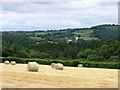
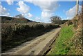
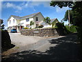
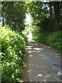
4 photos from this area
Area Information
Key information about the PL19 8PJ including its size, population, and administrative classification.
- Area Type
- Postcode
- Area Size
- 29.9 hectares
- Population
- 1692
- Population Density
- 31 people/km²
House Prices in PL19 8PJ
10
Properties
£298,333
Average Sold Price
£230,000
Lowest Price
£400,000
Highest Price
Showing 10 properties
| Address | Type | Beds | Baths | Last Sale Price | Last Sale Date | |
|---|---|---|---|---|---|---|
| Horsebridge House, Road From Horsebridge To Sydenham Cross, Horsebridge, PL19 8PJ | Detached | 4 | - | £400,000 | Jun 2021 | |
| Bealings, Road From Horsebridge To Sydenham Cross, Horsebridge, PL19 8PJ | Detached | - | - | £230,000 | Feb 2002 | |
| Riverslea, Road From Horsebridge To Lamerhooe Cross, Horsebridge, PL19 8PJ | house | - | - | £265,000 | May 2001 | |
| Lower Strowl, Road From Horsebridge To Lamerhooe Cross, Horsebridge, PL19 8PJ | Detached | 4 | 2 | - | - | |
| West View, Road From Horsebridge To Sydenham Cross, Horsebridge, PL19 8PJ | house | 4 | 2 | - | - | |
| Valleyside, Buddlemead Farm, Road From Horsebridge To Sydenham Cross, Horsebridge, PL19 8PJ | Detached | - | - | - | - | |
| Barn At Sx 402 754, Lane Past Sydenham Mill, Sydenham Damerel, PL19 8PJ | Farm | - | - | - | - | |
| Tamar View, Road From Horsebridge To Lamerhooe Cross, Horsebridge, PL19 8PJ | Terraced | - | - | - | - | |
| Tamar Cottage, Road From Horsebridge To Lamerhooe Cross, Horsebridge, PL19 8PJ | Bungalow | - | - | - | - | |
| Buddlemead Farm, Road From Horsebridge To Sydenham Cross, Horsebridge, PL19 8PJ | house | - | - | - | - |
Energy Efficiency in PL19 8PJ
Amenities
Schools
| Rank | School | Type | Entry gender | Ages |
|---|
Explore more schools in this area
Go to Schools tabDemographics
Household Size
Two person
most common
Accommodation Type
Houses
most common
Tenure
75
majority
Ethnic Group
White
most common
Religion
N/A
most common
Household Composition
N/A
most common
Age
47
median
Adults (30-64 years)
most common
Household Deprivation
N/A
with no deprivation
NS-SEC
38
in Lower managerial occupations
Explore more demographic insights in this area
Go to Demographics tabPlanning
Planning Constraints
- Flood RiskPremium
- Ramsar Wetland SitesPremium
- Area of Outstanding Natural BeautyPremium
- Protected Nature ReservePremium
- Protected WoodlandPremium