Area Overview for PL18 9RS
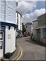
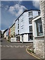
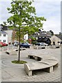
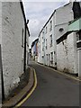
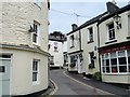
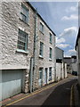
Photos of PL18 9RS


Area Information
Living in PL18 9RS offers a distinctly rural experience centred on a small residential cluster covering 593 square metres. The local community comprises 1556 residents, creating a tightly knit neighbourhood where locals know one another. This density results in 289 people per square kilometre, offering a slower pace of life compared to urban districts while retaining essential services. You will find a homes-focused environment where daily routines revolve around the immediate surroundings and nearby villages rather than city centres. The character of PL18 9RS is defined by its modest scale and quiet atmosphere, avoiding the congestion associated with larger conurbations. Potential homebuyers here benefit from a low population footprint, ensuring that the area maintains its identity as a peaceful locality. The area functions as a quiet retreat for those seeking stability without total isolation. Daily life involves manageable commuting distances and easy access to local shops and transport links. The limited residential footprint ensures that noise levels remain low and green spaces are accessible. Residents enjoy a lifestyle characterised by space and tranquility, unlike the denser housing markets found in city centres. You can appreciate the benefits of low density while still maintaining connectivity to broader regional networks. The specific postcode designation PL18 9RS identifies this precise cluster, distinguishing it from the wider rural Decorah landscape. It is a location for those who prioritise a clear view, quiet streets, and a sense of place over metropolitan convenience.
- Area Type
- Postcode
- Area Size
- 593 m²
- Population
- 1556
- Population Density
- 289 people/km²
The housing market in PL18 9RS is defined by an overwhelming preference for ownership. With 80% of homes owned by their occupants, the area functions primarily as an owner-occupied market rather than a rental hub. This statistic indicates that most households have invested in permanent residences, suggesting a mature housing stock where stability is the norm. The predominant accommodation type is houses, which aligns with the demographic profile of mature adults aged 30 to 64 years who typically seek permanent bases. You will rarely find purpose-built high-density flats or large social housing complexes in this specific postcode. Buying homes in PL18 9RS means entering a market where selling interest is often lower due to the entrenched nature of local ownership. The limited 593 square metre residential footprint means there are fewer properties available for sale at any given time compared to larger developments. This scarcity can drive competition if you are looking for specific house types within this cluster. Because the area is not a major rental destination, it may appeal strongly to those looking for a long-term investment or a family home where children can attend schools near PL18 9RS without housing volatility. The market reflects a desire for security, with residents likely staying put for decades rather than moving frequently.
House Prices in PL18 9RS
Showing 4 properties
| Address | Type | Beds | Baths | Last Sale Price | Last Sale Date | |
|---|---|---|---|---|---|---|
| 1, Poplar Cottages, Baptist Street, Calstock, PL18 9RS | house | 2 | 1 | £225,000 | Oct 2022 | |
| 2, Poplar Cottages, Baptist Street, Calstock, PL18 9RS | house | - | - | £210,000 | May 2021 | |
| 4, Poplar Cottages, Baptist Street, Calstock, PL18 9RS | Terraced | 2 | 1 | £147,000 | Feb 2021 | |
| 3, Poplar Cottages, Baptist Street, Calstock, PL18 9RS | Terraced | - | - | £152,500 | Jun 2006 |
Energy Efficiency in PL18 9RS
Lifestyle in PL18 9RS balances rural tranquility with convenient access to essential amenities. You have immediate access to five retail locations, ensuring daily shopping and household needs are met without long travel times. The Co-op Bere in Bere serves you for local groceries and essentials, while the Asda Gunnislake and Morrisons Tavistock provide larger supermarkets with fuller aisles. These five nearby shops create a functional retail environment where you do not need to travel extensively for basic supplies. Dining options naturally surround these high street locations, offering familiar comfort food and local produce close to your front door. The area also offers five railway connections, giving you the flexibility to explore further afield when desired. Calstock Railway Station, Bere Alston Railway Station, and Gunnislake Railway Station act as gateways to the wider region, allowing you to handle leisure trips or essential appointments efficiently. Living in PL18 9RS does not mean isolation; you maintain access to a functional network of shops and transport links. The small population of 1556 ensures that the local shops retain a friendly, community-oriented feel. You can walk or take a short drive to reach these amenities, making daily life practical and stress-free. This blend of proximity and space defines the everyday rhythm of residents here.
Amenities
Schools
| Rank | School | Type | Entry gender | Ages |
|---|
Explore more schools in this area
Go to Schools tabDemographics
The community in PL18 9RS features a median age of 47 years, reflecting a mature demographic profile. Most common age ranges fall within adults aged 30 to 64 years, indicating that families and empty-nesters dominate the local population. This age skew suggests a neighbourhood where residents have settled down and prioritise stability over rapid urban mobility. Home ownership stands at 80%, one of the highest rates likely found in the UK, meaning the vast majority of houses in PL18 9RS are owner-occupied rather than part of the private rental sector. This high retention rate fosters a stable environment with long-term residents rather than transient populations. The primary accommodation type consists of houses, aligning with the older demographic and the desire for detached or semi-detached living spaces rather than high-density flats. The predominant ethnic group is White, which is consistent with the traditional demographic makeup of many parts of Devon. With 80% ownership, you will encounter fewer landlords and more neighbours who have built their lives within the area. This stability often correlates with lower turnover rates and stronger community cohesion. The absence of a significant rental market means less short-term disruption and more predictable neighbourhood dynamics. For buyers, this implies a purchase into a established community where local knowledge and networks are deeply rooted.
Household Size
Accommodation Type
Tenure
Ethnic Group
Religion
Household Composition
Age
Household Deprivation
NS-SEC
Explore more demographic insights in this area
Go to Demographics tabPlanning
Planning Constraints
- Flood RiskPremium
- Ramsar Wetland SitesPremium
- Area of Outstanding Natural BeautyPremium
- Protected Nature ReservePremium
- Protected WoodlandPremium