Area Overview for PL17 8PH
Photos of PL17 8PH
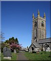
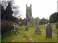
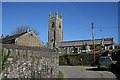
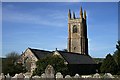


24 photos from this area
Area Information
Key information about the PL17 8PH including its size, population, and administrative classification.
- Area Type
- Postcode
- Area Size
- 15.2 hectares
- Population
- 1323
- Population Density
- 68 people/km²
House Prices in PL17 8PH
49
Properties
£189,655
Average Sold Price
£59,950
Lowest Price
£311,250
Highest Price
Showing 49 properties
| Address | Type | Beds | Baths | Last Sale Price | Last Sale Date | |
|---|---|---|---|---|---|---|
| 42 Kyl Cober Parc, Stoke Climsland, Callington, PL17 8PH | Retail | 2 | 2 | £265,000 | May 2022 | |
| 3 Kyl Cober Parc, Stoke Climsland, Callington, PL17 8PH | Semi-detached | 3 | - | £215,000 | May 2021 | |
| 47 Kyl Cober Parc, Stoke Climsland, Callington, PL17 8PH | house | - | - | £245,000 | Oct 2019 | |
| 8 Kyl Cober Parc, Stoke Climsland, Callington, PL17 8PH | house | - | - | £260,000 | Jul 2019 | |
| 48 Kyl Cober Parc, Stoke Climsland, Callington, PL17 8PH | Semi-detached | 4 | 2 | £272,000 | Jul 2019 | |
| 38 Kyl Cober Parc, Stoke Climsland, Callington, PL17 8PH | Detached | 3 | 2 | £275,000 | Sep 2017 | |
| 9 Kyl Cober Parc, Stoke Climsland, Callington, PL17 8PH | Semi-detached | 4 | 1 | £311,250 | Jun 2017 | |
| 11 Kyl Cober Parc, Stoke Climsland, Callington, PL17 8PH | Detached | 3 | - | £250,000 | May 2016 | |
| 45 Kyl Cober Parc, Stoke Climsland, Callington, PL17 8PH | Detached | 4 | 2 | £300,000 | May 2016 | |
| 37 Kyl Cober Parc, Stoke Climsland, Callington, PL17 8PH | Semi-detached | 3 | - | £249,000 | Sep 2015 |
Page 1 of 5
Energy Efficiency in PL17 8PH
Amenities
Schools
| Rank | School | Type | Entry gender | Ages |
|---|
Explore more schools in this area
Go to Schools tabDemographics
Household Size
Two person
most common
Accommodation Type
Houses
most common
Tenure
81
majority
Ethnic Group
White
most common
Religion
N/A
most common
Household Composition
N/A
most common
Age
47
median
Adults (30-64 years)
most common
Household Deprivation
N/A
with no deprivation
NS-SEC
38
in Lower managerial occupations
Explore more demographic insights in this area
Go to Demographics tabPlanning
Planning Constraints
- Flood RiskPremium
- Ramsar Wetland SitesPremium
- Area of Outstanding Natural BeautyPremium
- Protected Nature ReservePremium
- Protected WoodlandPremium