Area Overview for PL15 9YN
Photos of PL15 9YN


Area Information
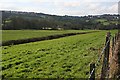
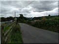
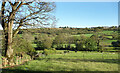
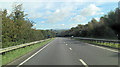
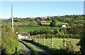
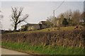
Living in PL15 9YN means residing in a small residential cluster situated within the PL15 postcode area. This specific location serves a population of 1,238 people, creating an intimate neighbourhood where residents likely know one another. The area covers a spread that results in a population density of 57 people per square kilometre. This figure indicates fairly low-density housing, typical of suburban or semi-rural environments rather than dense city centres. You will find a community defined by space and a clear separation from high-rise urban living. The postcode sits within England, offering the stability and familiarity associated with established British residential zones. Daily life here revolves around practical needs and local accessibility rather than sprawling metropolitan energy. The distinct character of PL15 9YN stems from its modest size and the specific demographic makeup of its inhabitants. Families and long-term residents dominate the scene, fostering a quiet rhythm to everyday activities.
- Area Type
- Postcode
- Area Size
- Not available
- Population
- 1238
- Population Density
- 57 people/km²
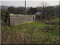
The property market in PL15 9YN is defined by a high degree of home ownership. Approximately 78% of homes are owner-occupied, meaning the vast majority of the 1,238 local residents live in properties they own. Accommodation in this postcode area consists almost entirely of houses. This absence of flats or high-density blocks is typical for a residential cluster located outside major urban centres. If you are looking at homes in PL15 9YN, you are evaluating a stock designed for people who intend to settle down. The lack of rental properties suggests a lower turnover rate and a community built on permanence rather than transient living. Buyers here may find that rising costs or specific preferences limit the number of listings available, as the area caters to a specific demographic seeking stability. The housing stock reflects a functional, home-focused environment rather than an investment property market.
House Prices in PL15 9YN
No properties found in this postcode.
Energy Efficiency in PL15 9YN
Residents of PL15 9YN find their shopping needs met by nearby retail hubs in Launceston. Within practical reach, you have five notable retail venues including Co-op Launceston and Tesco Launceston. These supermarkets offer the essentials for daily living, from groceries to household supplies. Having a Supermarket Cooper and Tesco nearby removes the need for bulky shopping journeys across the city. This retail density within a short distance defines the convenience of living in this postcode. You can rely on these major chains for most household requirements without venturing far from home. The presence of multiple Co-op locations suggests a well-serviced local area where quick trips are possible. While the area focuses on housing, these amenities ensure that basic lifestyle needs are met efficiently.
Amenities
Schools
Families living in PL15 9YN have access to Tregadillett Primary School. This institution is a primary school located near the area. The school holds an Ofsted rating of good, which signals a standard of education watched closely by local parents and the Department for Education. As a primary school, it caters to children from ages four to eleven, providing essential early education within the local community. The proximity of Tregadillett Primary School to PL15 9YN means that many local children can start their formal education without needing longer travel times to further north or south. No secondary schools are listed in the immediate vicinity, so families eventually need to consider transport links to outside locations for older children. The single primary option indicates a consolidated approach to early childhood education in this part of Launceston.
| Rank | School | Type | Entry gender | Ages |
|---|---|---|---|---|
| 1 | Tregadillett Primary School | primary | N/A | N/A |
Explore more schools in this area
Go to Schools tabDemographics
The community in PL15 9YN is mature and established. The median age stands at 47 years, reflecting a population primarily composed of adults aged between 30 and 64 years. This age profile suggests a neighbourhood populated by households with children, teenagers, and retired individuals rather than young professionals or students. Home ownership is the norm, with 78% of residents owning their properties outright or with a mortgage. Such a high ownership rate typically indicates long-term residents who do not move frequently. The predominant ethnic group is White, consistent with many traditional English rural and semi-rural settlements. Houses form the main type of accommodation, meaning you will encounter detached or semi-detached properties rather than blocks of flats. This demographic structure points to a stable environment where family units and older couples form the backbone of society.
Household Size
Accommodation Type
Tenure
Ethnic Group
Religion
Household Composition
Age
Household Deprivation
NS-SEC
Explore more demographic insights in this area
Go to Demographics tabPlanning
Planning Constraints
- Flood RiskPremium
- Ramsar Wetland SitesPremium
- Area of Outstanding Natural BeautyPremium
- Protected Nature ReservePremium
- Protected WoodlandPremium
- Crime RiskPremium