Area Overview for PL15 9PX
Photos of PL15 9PX
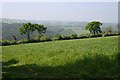
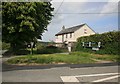
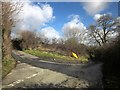
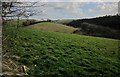

12 photos from this area
Area Information
Key information about the PL15 9PX including its size, population, and administrative classification.
- Area Type
- Postcode
- Area Size
- 16.0 hectares
- Population
- 1088
- Population Density
- 31 people/km²
House Prices in PL15 9PX
4
Properties
£290,000
Average Sold Price
£185,000
Lowest Price
£395,000
Highest Price
Showing 4 properties
| Address | Type | Beds | Baths | Last Sale Price | Last Sale Date | |
|---|---|---|---|---|---|---|
| East Cottage, Woodabridge, Lezant, Launceston, PL15 9PX | house | 4 | 2 | £395,000 | Apr 2019 | |
| Wooda Cottage, Woodabridge, Lezant, Launceston, PL15 9PX | house | - | - | £185,000 | Jan 2009 | |
| Kozi Cottage, Woodabridge, Lezant, Launceston, PL15 9PX | Detached | - | - | - | - | |
| Sanders Cottage, Woodabridge, Lezant, Launceston, PL15 9PX | Detached | - | - | - | - |
Energy Efficiency in PL15 9PX
Amenities
Schools
| Rank | School | Type | Entry gender | Ages |
|---|
Explore more schools in this area
Go to Schools tabDemographics
Household Size
Two person
most common
Accommodation Type
Houses
most common
Tenure
83
majority
Ethnic Group
White
most common
Religion
N/A
most common
Household Composition
N/A
most common
Age
47
median
Adults (30-64 years)
most common
Household Deprivation
N/A
with no deprivation
NS-SEC
37
in Lower managerial occupations
Explore more demographic insights in this area
Go to Demographics tabPlanning
Planning Constraints
- Flood RiskPremium
- Ramsar Wetland SitesPremium
- Area of Outstanding Natural BeautyPremium
- Protected Nature ReservePremium
- Protected WoodlandPremium