Area Overview for PL15 9PA
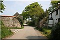
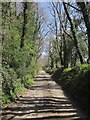
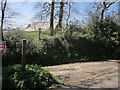
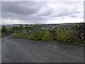
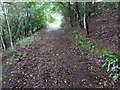
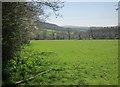
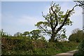
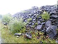
Photos of PL15 9PA


Area Information
PL15 9PA represents a small residential cluster covering 20.8 hectares with a population of 1,088. You will find yourself in an area with a density of 31 people per square kilometre, indicating a low-density environment typical of the Launceston outskirts. This specific postcode serves as a quiet sleep-out post for many, yet it remains part of the wider South west England context where traditional home life prevails. The area functions as a practical residential zone rather than a commercial hub. Daily life here revolves around proximity to the main town of Launceston, which provides all essential services within a short drive. Residents value the space available in a large parcel of land for a relatively small number of neighbours. Living in PL15 9PA means trading urban buzz for a more detached, peaceful existence. The layout supports those seeking a slower pace while maintaining access to the amenities of a historic market town. You navigate a landscape defined by its lower density and residential focus, making it a suitable choice for those prioritising space over city centre convenience. The area stands as a functional part of the local housing network, balancing growth with established character.
- Area Type
- Postcode
- Area Size
- 20.8 hectares
- Population
- 1088
- Population Density
- 31 people/km²
Homes in PL15 9PA are almost exclusively houses, with no flats recorded in the local housing stock. This accommodation type dominates the immediate surroundings and extends into the wider neighbourhood. The area exhibits an exceptional 83 per cent home ownership rate, meaning the market is primarily driven by owner-occupiers rather than private landlords. You are unlikely to encounter large blocks of rented accommodation or student housing in this specific cluster. The housing landscape consists of detached, semi-detached, or terraced houses typical of the Launceston region. Buyers entering this market will find a pool of older properties or established family homes rather than new-build developments. The high ownership figure suggests that sellers here are often individuals looking to remortgage, move up, or downsize, rather than institutional investors. This dynamic creates a buyer's market characterised by individual motivations and realistic asking prices. When viewing properties, expect to deal with private sellers managing their own unique needs rather than corporate estate agents. The lack of rental stock means that buying is generally required for anyone wishing to move permanently to this postcode.
House Prices in PL15 9PA
Showing 4 properties
| Address | Type | Beds | Baths | Last Sale Price | Last Sale Date | |
|---|---|---|---|---|---|---|
| 4, Roundhill Cottages, Road From Roundhill Cottages To The Lodge, Lezant, Launceston, PL15 9PA | Detached | 2 | 1 | £238,000 | Aug 2016 | |
| 3, Roundhill Cottages, Road From Roundhill Cottages To The Lodge, Lezant, Launceston, PL15 9PA | Terraced | 2 | 1 | £131,200 | Mar 2014 | |
| 1, Roundhill Cottages, Road From Roundhill Cottages To The Lodge, Lezant, Launceston, PL15 9PA | house | 3 | - | £140,000 | May 2011 | |
| 2, Roundhill Cottages, Road From Roundhill Cottages To The Lodge, Lezant, Launceston, PL15 9PA | Terraced | - | - | £203,000 | Oct 2007 |
Energy Efficiency in PL15 9PA
Living in PL15 9PA puts you within practical reach of five retail amenities located in the town of Launceston. These include Lidl Launceston, M&S Launceston, and Tesco Launceston, which form the core of your daily shopping needs. With no local amenities listed within the specific postcode, residents make regular trips to the main town centre for groceries and household necessities. The presence of these three major supermarkets ensures you can buy fresh produce and daily essentials without needing specialist boutiques. While dining and leisure options are not explicitly listed in the nearby amenities data, the city centre of Launceston provides a wider range of pubs, restaurants, and entertainment venues a short drive away. This arrangement suits those who prefer a larger town centre for evening activities but want a quiet residential base. The convenience of three major stores means you do not constantly travel to other postcodes for basic requirements. Life here balances the tranquility of a small residential cluster with the conveniences of a market town.
Amenities
Schools
Families living in PL15 9PA benefit from Trekenner Community Primary School, located in close proximity to the residential cluster. This State-fund primary school holds a satisfactory Ofsted rating, indicating it meets the expected standards for education and child safety. As the nearest school listed, it serves as the primary educational anchor for younger children in the area. The mention of a primary school suggests that this location is family-friendly, although secondary education options are not detailed in the local dataset. Residents relying on this school have access to a institution that is within reasonable commuting distance for the majority of families. The school's rating of satisfactory provides a baseline assurance that children will receive a standard education whilst growing up near PL15 9PA. You should check transport links directly to the school for precise travel times, but the current data confirms the presence of this educational facility. For elementary education, Trekenner Community Primary School represents the main choice for local pupils.
| Rank | School | Type | Entry gender | Ages |
|---|
Explore more schools in this area
Go to Schools tabDemographics
The community in PL15 9PA reflects a mature demographic profile with a median age of 47 years. The most common age group consists of adults between 30 and 64 years, suggesting a population dominated by established residents and families in their middle years. Homeownership stands high at 83 per cent, indicating that the vast majority of households have secured their own mortgage or own properties outright. This high rate of ownership typically correlates with a stable, settled community where long-term residents form the backbone of local life. Houses are the predominant accommodation type, meaning you will encounter very few flats or purpose-built apartments. The predominant ethnic group is White, which aligns with the broader demographic patterns of the region. There is minimal deprivation indicated by the stable age profile and high ownership rates. This data paints a picture of a traditional British neighbourhood where multi-generational families or retirees purchasing downsize homes are common. The social fabric is built on local knowledge and long-term community ties rather than transient populations.
Household Size
Accommodation Type
Tenure
Ethnic Group
Religion
Household Composition
Age
Household Deprivation
NS-SEC
Explore more demographic insights in this area
Go to Demographics tabPlanning
Planning Constraints
- Flood RiskPremium
- Ramsar Wetland SitesPremium
- Area of Outstanding Natural BeautyPremium
- Protected Nature ReservePremium
- Protected WoodlandPremium