Area Overview for PL15 8NR
Photos of PL15 8NR
Area Information
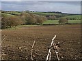
PL15 8NR occupies a specific residential cluster spanning 2.9 square kilometres in the UK. This postcode serves a defined population of 2,706 residents, creating a compact community where neighbours are likely to know one another. The area operates on a low population density of 28 people per square kilometre, which suggests a quiet environment rather than a bustling high street atmosphere. Daily life here centres on a small-scale neighbourhood layout where homes are spread out enough to offer privacy but close enough to foster local connections. Prospective buyers considering living in PL15 8NR will find a setting defined by its manageable size and distinct boundaries. The area does not sprawl over vast distances; instead, it functions as a self-contained pocket of the wider region. This concentration means that local amenities, schools, and transport links are all within practical walking or short driving distance for most households. The character of the postcode is shaped by this intimacy, where residents enjoy a sense of place without the noise and congestion of larger urban centres. For those seeking a home in a setting that values stability and local roots, this area presents a clear alternative to more crowded locations.
- Area Type
- Postcode
- Area Size
- 2.9 km²
- Population
- 2706
- Population Density
- 28 people/km²
The property market in PL15 8NR is defined by a strong inclination towards home ownership rather than rental living. With 73 per cent of households owning their homes, this area functions primarily as an owner-occupied market. This statistic reveals that properties here are often passed down through generations or purchased for long-term stability. The accommodation type is exclusively houses, indicating a housing stock focused on detached, semi-detached, or terraced family dwellings rather than urban apartments or maisonettes. Such a configuration appeals to those seeking yard space, gardens, or the former detached nature typical of open postcodes. Buying a home in PL15 8NR means entering a market where sentimentality and legacy often drive value alongside location. The lack of rental data suggests a absence of short-term letting or social housing dominance, which is common in more transient urban zones. For investors or individuals looking to build equity, the high ownership rate signals a stable market with lower tenant turnover. Potential buyers should note that the specific constraints of a 2.9 square kilometre area might limit immediate supply, meaning competition for suitable houses could be keen. This market dynamic favours students, families, or buyers who intend to stay in the area for years. The predominance of houses also implies that extensions or garden conversions are the primary avenues for increasing property value.
House Prices in PL15 8NR
Showing 32 properties
Energy Efficiency in PL15 8NR
Daily life in PL15 8NR revolves around immediate access to essential retail services within a short distance. Residents can walk or drive quickly to Spar stores, which are noted as being present in the local area. Additionally, Budgens Greenaways serves as a supermarket option, providing a contrast for shoppers seeking different ranges or prices. These five retail venues collectively ensure that groceries and daily essentials are within practical reach without needing a long journey. The concentration of these shops creates a convenient hub for weekly shopping runs, reducing the need for extensive car travel. While the area lacks the extensive leisure or dining hubs of larger towns, the presence of Spar and Budgens covers the primary needs for food and household goods. Living in PL15 8NR means shopping trips are decided by proximity rather than the search for the latest fashion trends or gourmet restaurants. For those who prefer a quiet lifestyle where daily necessities are handled quickly, this arrangement works well. The limited notable amenities list reflects the rural or semi-rural nature of the postcode, where locals often plan weekend trips to larger centres for broader entertainment. This simplicity supports a lifestyle centred on home, family, and local friends rather than public nightlife or commercial bustle.
Amenities
Schools
Families residing in PL15 8NR have access to a mix of state and independent educational institutions nearby. Boyton Community Primary School serves as a local primary option within the area. Residents can also choose Whitstone Primary School, which holds an Ofsted rating of good, providing a secure foundation for younger children. Jacobstow Community Primary School offers another state-funded alternative for primary education within the catchment vicinity. For families seeking alternatif education, Tamar Christian School operates as an independent option in the surrounding vicinity. Whitstone Head School is also present in the local area, specialising in special educational needs provision. This variety allows parents to tailor schooling choices based on academic preference or specific support requirements. The presence of both community schools and an independent school indicates a broad range of educational philosophies and intake sizes available to the community. While these schools are not all detailed with full inspection reports in this snapshot, the inclusion of ranked institutions suggests a standard of quality that meets regional benchmarks. Families considering living in PL15 8NR will need to check specific catchment boundaries against their preferred schools. The proximity of multiple primary institutions means that transport to school is likely straightforward for most households in this residential cluster.
| Rank | School | Type | Entry gender | Ages |
|---|
Explore more schools in this area
Go to Schools tabDemographics
The community within PL15 8NR displays a distinctly mature demographic profile, with a median age of 47 years. Adults aged between 30 and 64 years form the most common age range in the area, indicating a population that has likely settled down to raise families or enjoy retirement. This age distribution points towards a neighbourhood where long-term residents value stability and quiet surroundings. Home ownership stands at a strong 73 per cent, suggesting that the vast majority of households have lived in their properties for the long term. Houses dominate the accommodation type data, meaning buyers will encounter detached or semi-detached dwellings rather than high-rise flats or apartments. The predominant ethnic group is White, which aligns with the typical demographic composition of many rural or semi-rural English postcodes. These figures describe a homogeneous community where social structures have remained relatively consistent over time. High ownership rates often correlate with lower turnover of residents, contributing to the established feel of the district. Families and older couples form the backbone of this social fabric, supporting local institutions and maintaining a steady demand for family-sized homes. Understanding these demographics helps buyers gauge whether the social rhythm of PL15 8NR matches their own lifestyle expectations.
Household Size
Accommodation Type
Tenure
Ethnic Group
Religion
Household Composition
Age
Household Deprivation
NS-SEC
Explore more demographic insights in this area
Go to Demographics tabPlanning
Planning Constraints
- Flood RiskPremium
- Ramsar Wetland SitesPremium
- Area of Outstanding Natural BeautyPremium
- Protected Nature ReservePremium
- Protected WoodlandPremium