Area Overview for PL15 7FW
Photos of PL15 7FW
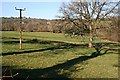
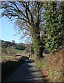

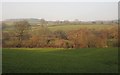
4 photos from this area
Area Information
Key information about the PL15 7FW including its size, population, and administrative classification.
- Area Type
- Postcode
- Area Size
- 3.7 hectares
- Population
- 1238
- Population Density
- 57 people/km²
House Prices in PL15 7FW
37
Properties
£265,020
Average Sold Price
£166,125
Lowest Price
£670,000
Highest Price
Showing 37 properties
| Address | Type | Beds | Baths | Last Sale Price | Last Sale Date | |
|---|---|---|---|---|---|---|
| 26 Barrabill Way, Launceston, PL15 7FW | house | - | - | £251,417 | Oct 2025 | |
| 42 Barrabill Way, Launceston, PL15 7FW | Semi-detached | 3 | 2 | £265,000 | Jun 2025 | |
| 44 Barrabill Way, Launceston, PL15 7FW | house | 3 | 2 | £249,950 | Oct 2023 | |
| 32 Barrabill Way, Launceston, PL15 7FW | house | - | - | £309,995 | Feb 2022 | |
| 28 Barrabill Way, Launceston, PL15 7FW | house | - | - | £199,995 | Jan 2022 | |
| 30 Barrabill Way, Launceston, PL15 7FW | house | - | - | £194,995 | Jan 2022 | |
| 24 Barrabill Way, Launceston, PL15 7FW | house | - | - | £193,995 | Dec 2021 | |
| 40 Barrabill Way, Launceston, PL15 7FW | Detached | 3 | 2 | £279,995 | Dec 2021 | |
| 36 Barrabill Way, Launceston, PL15 7FW | house | - | - | £299,995 | Dec 2021 | |
| 34 Barrabill Way, Launceston, PL15 7FW | house | - | - | £329,995 | Dec 2021 |
Page 1 of 4
Energy Efficiency in PL15 7FW
Amenities
Schools
| Rank | School | Type | Entry gender | Ages |
|---|
Explore more schools in this area
Go to Schools tabDemographics
Household Size
Two person
most common
Accommodation Type
Houses
most common
Tenure
78
majority
Ethnic Group
White
most common
Religion
N/A
most common
Household Composition
N/A
most common
Age
47
median
Adults (30-64 years)
most common
Household Deprivation
N/A
with no deprivation
NS-SEC
26
in Lower managerial occupations
Explore more demographic insights in this area
Go to Demographics tabPlanning
Planning Constraints
- Flood RiskPremium
- Ramsar Wetland SitesPremium
- Area of Outstanding Natural BeautyPremium
- Protected Nature ReservePremium
- Protected WoodlandPremium