Area Overview for PL14 3DW
Photos of PL14 3DW


Area Information
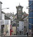
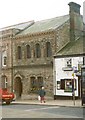
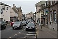
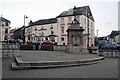
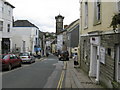
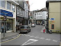
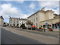
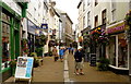
PL14 3DW is a compact residential cluster located in Liskeard, Cornwall. This specific postcode covers an area comprising 5,291 square metres, housing a population of 1,474 residents. The location is defined by its small scale, providing immediate proximity to town centre facilities rather than isolation. Living in this area means navigating a neighbourhood where residents rely on local infrastructure for daily needs. The density here creates an environment where services are within easy reach, avoiding the long commutes typical of more peripheral locations. You will find yourself surrounded by a community that balances suburban tranquillity with urban convenience. The area sits near key transport links, including the Liskeard Railway Station, which anchors its connectivity to the wider Cornwall network. This postcode represents a practical choice for those seeking a settled environment with direct access to shops and public transport. The small footprint ensures that you are never far from a supermarket or a train station, making it a logical hub for local life in the town.
- Area Type
- Postcode
- Area Size
- 5291 m²
- Population
- 1474
- Population Density
- 2774 people/km²
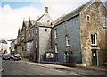
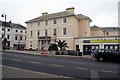
The housing market in PL14 3DW is characterised by a specific mix of ownership and accommodation styles. Houses represent the definitive accommodation type for this postcode, distinguishing it from areas dominated by tenements or flats. Home ownership stands at 41%, suggesting that while rental properties exist, owner-occupied homes are a significant feature of the streetscape. This 41% ownership rate implies a steady demand for month-based or permanent rental alternatives, yet the primary stock consists of traditional housing stock. If you are looking to purchase, you will find a market focused on detached or semi-detached properties rather than high-density blocks. The nature of the housing reflects the age of the residents, favouring spaces suitable for families or individuals in the 30 to 64 age bracket. Buyers searching for homes in this area should anticipate a landscape of single-family dwellings. The prevalence of houses over other types means limited options for those seeking tier-specific architecture, requiring a focus on the traditional residential stock available in Cornwall.
House Prices in PL14 3DW
No properties found in this postcode.
Energy Efficiency in PL14 3DW
Amenities
Schools
Families living in PL14 3DW have access to Liskeard School and Community College for their children's education. This institution operates as both a primary and an academy, serving different educational stages within the same campus. The dual function means you have a single institution to engage with for multiple child age groups. This setup simplifies decision-making for parents, offering a consistent educational environment from primary through secondary phases. When considering schools near PL14 3DW, this college is the central option provided for the immediate locality. The academy status indicates a modern governance structure, while the primary designation covers younger students. You will not find separate nursery or independent schools listed in the immediate data, making this integrated college pivotal for local schooling. The presence of both primary and academy functions ensures a broad curriculum is available nearby. For those prioritising education access, this single provider offers a comprehensive solution without the need to commute to other towns for schooling.
| Rank | School | Type | Entry gender | Ages |
|---|
Explore more schools in this area
Go to Schools tabDemographics
The community in PL14 3DW reflects a mature population profile. The median age stands at 47 years, with adults aged between 30 and 64 years forming the most common age range. Home ownership is prevalent, accounting for 41% of households within this vicinity. This figure indicates a significant portion of residents have settled locally rather than renting short-term tenancies. The predominant accommodation type is houses, which aligns with the age demographic and ownership levels. Ethnic diversity shows the predominant group is White, consistent with the broader county demographics. You will encounter a neighbourhood where stability is common, driven by long-term residents owning their family homes. The age profile suggests a shift away from young families, pointing towards an area where mid-life professionals and retirees reside. This demographic mix influences the local character, creating a quiet residential zone rather than a hub of transient visitors. Property buyers here should expect an environment defined by permanence and established community bonds.
Household Size
Accommodation Type
Tenure
Ethnic Group
Religion
Household Composition
Age
Household Deprivation
NS-SEC
Explore more demographic insights in this area
Go to Demographics tabPlanning
Planning Constraints
- Flood RiskPremium
- Ramsar Wetland SitesPremium
- Area of Outstanding Natural BeautyPremium
- Protected Nature ReservePremium
- Protected WoodlandPremium