Area Overview for PL13 2LP
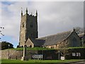
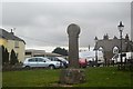
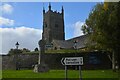
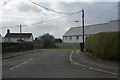
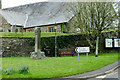
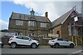
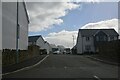
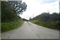
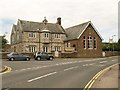
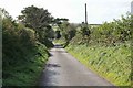
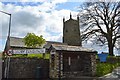
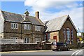
Photos of PL13 2LP
Area Information
PL13 2LP represents a compact residential cluster comprising only 2.5 hectares, home to a total population of 1,841 people. Living in this postcode means existing within a small-scale environment defined by a density of 59 people per square kilometre. You will find a community focused on a specific local footprint rather than sprawling urban development. The area sits in Cornwall, England, functioning as a distinct neighbourhood separate from larger towns. Daily life revolves around this intimate setting where the number of residents remains relatively static at under two thousand. This size creates a close-knit feel without the congestion of major cities. Residents access a range of nearby services including railways and ferries that extend their practical reach beyond the immediate borders. The proximity to water transport options like the Bodinnick Ferry Landing and various quays in Fowey adds variety to standard travel routines. Homes in PL13 2LP cater to those seeking a contained living space with defined boundaries. The area avoids the anonymity of larger districts because its small physical size ensures neighbours often know each other. You can navigate this postcode without dealing with endless traffic or sprawling infrastructure networks. The community maintains a clear identity rooted in its specific geographical limits.
- Area Type
- Postcode
- Area Size
- 2.5 hectares
- Population
- 1841
- Population Density
- 59 people/km²
The property market in PL13 2LP is characterised by a strong culture of ownership rather than renting. With 72% of households in the area being owner-occupied, you will face a market dominated by existing homeowners looking to sell. This high percentage indicates long-term stability and a lack of transient rental turnover. Houses represent the primary accommodation type, meaning you will see a landscape of traditional detached or semi-detached homes rather than purpose-built blocks or flats. This stock suits those seeking space and privacy within a small 2.5 hectare area. When searching for homes in PL13 2LP, expect properties designed for permanent living rather than short-term lets. The low population of 1,841 means the total number of available properties is naturally limited compared to larger towns. Buying here involves entering a market where residents have deep roots and emotional ties to their specific properties. You do not find high-density blocks typical of urban centres but rather individual residential plots. The 72% ownership figure suggests that price negotiation often involves dealing with people who intend to stay rather than investors. This market structure offers stability but may limit availability for newcomers compared to areas with higher rental shares. The housing stock aligns perfectly with the demographic profile of an older community.
House Prices in PL13 2LP
Showing 31 properties
| Address | Type | Beds | Baths | Last Sale Price | Last Sale Date | |
|---|---|---|---|---|---|---|
| The White House, Summer Lane, Pelynt, PL13 2LP | Detached | 3 | 2 | £215,000 | Jul 2025 | |
| 6 Summer Lane, Pelynt, PL13 2LP | Terraced | 3 | 1 | £165,000 | Aug 2024 | |
| 8 Summer Lane, Pelynt, PL13 2LP | Terraced | 1 | 1 | £156,000 | Feb 2020 | |
| The New House, Summer Lane, Pelynt, PL13 2LP | Detached | 4 | - | £200,000 | Nov 2013 | |
| Ridgebourne, Summer Lane, Pelynt, PL13 2LP | Detached | - | - | £290,000 | Sep 2007 | |
| 5 Summer Lane, Pelynt, PL13 2LP | Detached | 4 | 1 | £38,000 | Nov 1996 | |
| Higher Grange Cottage, 19 Summer Lane, Pelynt, PL13 2LP | Land | - | - | - | - | |
| The Old Chapel, 4 Summer Lane, Pelynt, PL13 2LP | Detached | 3 | 2 | - | - | |
| The Firs, Summer Lane, Pelynt, PL13 2LP | Detached | 4 | 3 | - | - | |
| Chapel Cottage, 3 Summer Lane, Pelynt, PL13 2LP | Cottage | 3 | 1 | - | - |
Energy Efficiency in PL13 2LP
Your lifestyle in PL13 2LP relies on a practical network of nearby amenities within walking or driving distance. Residents have access to five retail outlets including Spar, Spar, and Co-op East for daily shopping needs. Transport connectivity is enhanced by five rail stations, with Sandplace Railway Station, Looe Railway Station, and Causeland Railway Station serving as key hubs. Five ferry landings also provide coastal access, notably Bodinnick Ferry Landing, Fowey Custom House Quay Ferry Landing, and Fowey Town Quay Ferry Landing. This combination means you can reach towns via train or boat without extensive road travel. Shopping is straightforward with multiple grocery options like Co-op East available close by. Those living in PL13 2LP enjoy direct links to Fowey through the ferry network. The presence of these specific venues ensures you do not need to travel far for essentials. Rail access allows quick trips to Looe or beyond for leisure or work. The density of these options provides convenience without clutter. You can run errands at Spar while maintaining easy rail access to larger destinations. Ferry services expand your world significantly given the coastal location. These facilities form the backbone of your accessible daily life.
Amenities
Schools
Residents of PL13 2LP benefit from education facilities with established reputations and clear safety standards. Pelynt School operates as a primary institution within reasonable travel distance. Further selection includes Pelynt Primary Academy, which holds a Good rating from Ofsted, indicating strong educational oversight and outcomes. Both schools focus on early childhood and secondary education before students move to comprehensive high schools elsewhere. The presence of two primary options gives families flexibility when choosing schools near PL13 2LP. You will find that the local education provision is robust with at least one school achieving top-tier regulatory status. This mix of primary schools supports families raising children in the area. The Good rating from Ofsted for Pelynt Primary Academy provides a concrete fact for parents assessing quality. These institutions serve the local catchment area, reducing the need for long commutes to distant academies. While secondary options are not listed in the immediate data, primary education is well-supported for young families living in this postcode. The availability of these specific named schools ensures you have local educational infrastructure.
| Rank | School | Type | Entry gender | Ages |
|---|
Explore more schools in this area
Go to Schools tabDemographics
The community in PL13 2LP has a median age of 47 years, indicating an older population demographic. Data shows that the elderly, defined as those aged 65 years and over, form the most common age group within this neighbourhood. This age structure shapes the character of the area and influences local service demand. Home ownership stands at 72%, meaning the majority of residents own their properties outright or with a mortgage rather than renting. Houses dominate the accommodation type, confirming that you will find predominantly detached or semi-detached housing rather than flats or apartments. The predominant ethnic group is White, reflecting the traditional demographic makeup of this rural location. Deprivation data is not included in the available records, so no specific statement can be made regarding economic hardship levels. Instead, the high home ownership rate suggests financial stability among long-term residents. The population density of 59 people per square kilometre provides a quiet environment suitable for families or retirees. This accommodation profile excludes many younger residents or those seeking urban rental markets. The demographic mix points to a settled community where people have likely stayed for many years. You are looking at an area where older generations remain the primary demographic drivers.
Household Size
Accommodation Type
Tenure
Ethnic Group
Religion
Household Composition
Age
Household Deprivation
NS-SEC
Explore more demographic insights in this area
Go to Demographics tabPlanning
Planning Constraints
- Flood RiskPremium
- Ramsar Wetland SitesPremium
- Area of Outstanding Natural BeautyPremium
- Protected Nature ReservePremium
- Protected WoodlandPremium