Area Overview for PL13 2BS
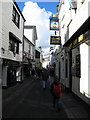
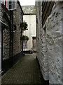
Photos of PL13 2BS


Area Information
Living in PL13 2BS means residing in a small residential cluster defined by its specific postcode. This relatively compact area covers just 483 m² of land yet supports a local population of 2,276 people. Despite its small footprint, the density is significant, with 2,153 people per square kilometre shaping the character of daily life. The environment is primarily residential, catering to those who value proximity to their neighbours and a contained living space. You will find yourself in a tightly knit community where every street corner likely serves as a gathering point for the local populace. The scale of the area suggests a focus on intimate local interactions rather than the anonymity of larger housing estates. Prospective buyers should understand that purchasing a home here involves joining a specific, well-defined pocket of the wider region. The layout supports a quiet existence, yet the high population density ensures that the area remains active and engaged. When you explore PL13 2BS, you are entering a zone where the balance between privacy and community presence is carefully maintained through the sheer concentration of dwellings within such a limited geographical boundary.
- Area Type
- Postcode
- Area Size
- 483 m²
- Population
- 2276
- Population Density
- 2153 people/km²
The property market in PL13 2BS is characterised by a strong preference for owner-occupied housing. With 77% of homes owned by their occupants, this area functions largely as a residence for settled families rather than a hub for short-term rentals or student housing. Houses dominate the local housing stock, aligning with the demographic trend of adults aged 30 to 64 seeking space and stability. When looking at homes in PL13 2BS, you are dealing with a stock that has likely been lived in for significant periods, given the high ownership rate. This environment suits individuals who intend to stay put and invest in their long-term future rather than those looking for quick turnovers. The primary concentration of households implies a consistent demand for maintenance and community integration. Buyers should expect a market where local knowledge of property history is valuable. The prevalence of houses over flats means that garden space and traditional architectural styles are likely standard features.
House Prices in PL13 2BS
Showing 8 properties
| Address | Type | Beds | Baths | Last Sale Price | Last Sale Date | |
|---|---|---|---|---|---|---|
| 4, Dingles Folly, Chapel Ground, West Looe, PL13 2BS | Flat | 2 | 1 | - | - | |
| 5, Dingles Folly, Chapel Ground, West Looe, PL13 2BS | Flat | 2 | 1 | - | - | |
| 7, Dingles Folly, Chapel Ground, West Looe, PL13 2BS | Maisonette | 3 | 1 | - | - | |
| 2, Dingles Folly, Chapel Ground, West Looe, PL13 2BS | Flat | 2 | 1 | - | - | |
| 6, Dingles Folly, Chapel Ground, West Looe, PL13 2BS | Flat | - | - | - | - | |
| 8, Dingles Folly, Chapel Ground, West Looe, PL13 2BS | Flat | - | - | - | - | |
| 3, Dingles Folly, Chapel Ground, West Looe, PL13 2BS | Flat | - | - | - | - | |
| 1, Dingles Folly, Chapel Ground, West Looe, PL13 2BS | Flat | - | - | - | - |
Energy Efficiency in PL13 2BS
Daily life in PL13 2BS offers straightforward access to essential amenities within practical reach of your doorstep. Local retail options include Spar, Co-op Looe, and Co-op East, ensuring you can grab essentials without travelling far. For those who commute or travel, five railway stations are located nearby, providing vital transport links. Looe Railway Station, Sandplace Railway Station, and Causeland Railway Station offer convenient connections to the wider network. This proximity to rail hubs means you are positioned well for journeys beyond your immediate neighbourhood. The presence of multiple service points like the Co-op and Spar indicates that your weekly shopping needs are met locally. You do not need to plan long drives just to access basic services or catch a train. The concentration of these facilities creates a convenient loop for your daily routine. Whether you are stocking the cupboards or heading to the station, the infrastructure in PL13 2BS supports a functional and accessible lifestyle without unnecessary delays.
Amenities
Schools
| Rank | School | Type | Entry gender | Ages |
|---|
Explore more schools in this area
Go to Schools tabDemographics
The community within PL13 2BS reflects a mature population structure, with a median age of 47 years. The most common age range consists of adults between 30 and 64 years old, indicating a diverse but predominantly mid-life demographic. You will encounter fewer young families with small children compared to the sheer number of settled adults in the homes near this postcode. This age profile strongly suggests a settlement where people have established roots and prioritised stability over transient living arrangements. Home ownership rates stand at a robust 77%, confirming that the vast majority of residents are self-employed or climbing the property ladder to secure their own footing. Houses form the predominant accommodation type, meaning you will find traditional detached or semi-detached structures rather than high-rise flats or purpose-built apartments. The population is predominantly White, contributing to a community with a distinct cultural homogeneity. These figures paint a clear picture of a settled neighbourhood where long-term residents make up the backbone of the social fabric.
Household Size
Accommodation Type
Tenure
Ethnic Group
Religion
Household Composition
Age
Household Deprivation
NS-SEC
Explore more demographic insights in this area
Go to Demographics tabPlanning
Planning Constraints
- Flood RiskPremium
- Ramsar Wetland SitesPremium
- Area of Outstanding Natural BeautyPremium
- Protected Nature ReservePremium
- Protected WoodlandPremium