Area Overview for PL13 1PA
Photos of PL13 1PA
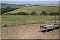
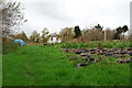
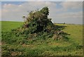
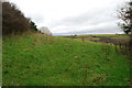
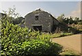
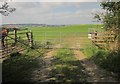
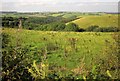
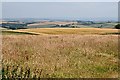
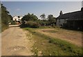
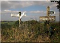
10 photos from this area
Area Information
Key information about the PL13 1PA including its size, population, and administrative classification.
- Area Type
- Postcode
- Area Size
- 2.1 km²
- Population
- 1882
- Population Density
- 198 people/km²
House Prices in PL13 1PA
16
Properties
£282,500
Average Sold Price
£10,000
Lowest Price
£430,000
Highest Price
Showing 16 properties
| Address | Type | Beds | Baths | Last Sale Price | Last Sale Date | |
|---|---|---|---|---|---|---|
| Cockles Peep Out, Road From Bucklawren Road To Looe Hill, St Martin, PL13 1PA | house | 3 | 2 | £10,000 | Mar 2020 | |
| An Skyber, Looe Hill, Seaton, PL13 1PA | Detached | 3 | - | £430,000 | Oct 2016 | |
| Struddicks Cottage, Looe Hill, Seaton, PL13 1PA | Land | - | - | £320,000 | Apr 2004 | |
| Keveral Barton Manor, Road From Bucklawren Road To Looe Hill, St Martin, PL13 1PA | Detached | - | - | £370,000 | Nov 2002 | |
| Plowd-rytyn Barn, Penhale Farm, Road From Bucklawren Road To Looe Hill, St Martin, PL13 1PA | Detached | 4 | - | - | - | |
| Bokenver Farm, Road From Bucklawren Road To Looe Hill, St Martin, PL13 1PA | Land | - | - | - | - | |
| Penhale, Road From Bucklawren Road To Looe Hill, St Martin, PL13 1PA | Bungalow | 3 | 1 | - | - | |
| The Vineyard, Looe Hill, Seaton, PL13 1PA | house | 7 | - | - | - | |
| Piggery Barn At, Keveral Farm, Road From Bucklawren Road To Looe Hill, St Martin, PL13 1PA | Semi-detached | - | - | - | - | |
| Keveral Farmers Limited, Keveral Camp Site, Keveral Farm, Road From Bucklawren Road To Looe Hill, St Martin, PL13 1PA | commercial | - | - | - | - |
Page 1 of 2
Energy Efficiency in PL13 1PA
Amenities
Schools
| Rank | School | Type | Entry gender | Ages |
|---|
Explore more schools in this area
Go to Schools tabDemographics
Household Size
Two person
most common
Accommodation Type
Houses
most common
Tenure
62
majority
Ethnic Group
White
most common
Religion
N/A
most common
Household Composition
N/A
most common
Age
47
median
Adults (30-64 years)
most common
Household Deprivation
N/A
with no deprivation
NS-SEC
23
in Lower managerial occupations
Explore more demographic insights in this area
Go to Demographics tabPlanning
Planning Constraints
- Flood RiskPremium
- Ramsar Wetland SitesPremium
- Area of Outstanding Natural BeautyPremium
- Protected Nature ReservePremium
- Protected WoodlandPremium