Area Overview for PL13 1NE
Photos of PL13 1NE

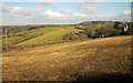
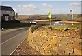
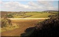
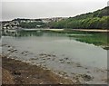

47 photos from this area
Area Information
Key information about the PL13 1NE including its size, population, and administrative classification.
- Area Type
- Postcode
- Area Size
- 8297 m²
- Population
- 1882
- Population Density
- 198 people/km²
House Prices in PL13 1NE
18
Properties
£171,333
Average Sold Price
£33,000
Lowest Price
£230,000
Highest Price
Showing 18 properties
| Address | Type | Beds | Baths | Last Sale Price | Last Sale Date | |
|---|---|---|---|---|---|---|
| 79 Sunrising, Looe, PL13 1NE | Semi-detached | 3 | 1 | £225,000 | Dec 2025 | |
| 73 Sunrising, Looe, PL13 1NE | Terraced | 3 | 2 | £230,000 | Jan 2022 | |
| 58 Sunrising, Looe, PL13 1NE | Semi-detached | 3 | 1 | £157,000 | May 2018 | |
| 75 Sunrising, Looe, PL13 1NE | house | - | - | £160,000 | Feb 2018 | |
| 60 Sunrising, Looe, PL13 1NE | Semi-detached | 4 | 2 | £165,000 | Jun 2017 | |
| 48 Sunrising, Looe, PL13 1NE | Semi-detached | - | - | £180,000 | Jun 2008 | |
| 50 Sunrising, Looe, PL13 1NE | Semi-detached | - | - | £165,000 | Mar 2007 | |
| Treetops, Sunrising, Looe, PL13 1NE | house | 3 | - | £227,000 | Apr 2006 | |
| 56 Sunrising, Looe, PL13 1NE | house | 3 | - | £33,000 | Mar 2002 | |
| 71 Sunrising, Looe, PL13 1NE | Semi-detached | - | - | - | - |
Page 1 of 2
Energy Efficiency in PL13 1NE
Amenities
Schools
| Rank | School | Type | Entry gender | Ages |
|---|
Explore more schools in this area
Go to Schools tabDemographics
Household Size
Two person
most common
Accommodation Type
Houses
most common
Tenure
62
majority
Ethnic Group
White
most common
Religion
N/A
most common
Household Composition
N/A
most common
Age
47
median
Adults (30-64 years)
most common
Household Deprivation
N/A
with no deprivation
NS-SEC
23
in Lower managerial occupations
Explore more demographic insights in this area
Go to Demographics tabPlanning
Planning Constraints
- Flood RiskPremium
- Ramsar Wetland SitesPremium
- Area of Outstanding Natural BeautyPremium
- Protected Nature ReservePremium
- Protected WoodlandPremium