Area Overview for PL13 1DG
Photos of PL13 1DG
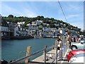
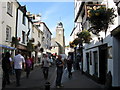
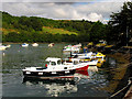
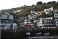
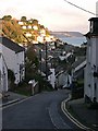
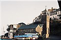
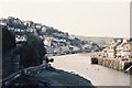

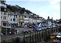
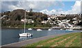
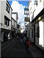
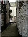
100 photos from this area
Area Information
Key information about the PL13 1DG including its size, population, and administrative classification.
- Area Type
- Postcode
- Area Size
- 2.7 hectares
- Population
- 2276
- Population Density
- 2153 people/km²
House Prices in PL13 1DG
19
Properties
£223,309
Average Sold Price
£75,000
Lowest Price
£375,000
Highest Price
Showing 19 properties
| Address | Type | Beds | Baths | Last Sale Price | Last Sale Date | |
|---|---|---|---|---|---|---|
| 1 St Winnolls Park, East Looe, PL13 1DG | Bungalow | 2 | 2 | £325,000 | Oct 2025 | |
| 5 St Winnolls Park, East Looe, PL13 1DG | Bungalow | - | - | £362,500 | Apr 2022 | |
| 15 St Winnolls Park, East Looe, PL13 1DG | Bungalow | 3 | 1 | £375,000 | Aug 2021 | |
| 6 St Winnolls Park, East Looe, PL13 1DG | Bungalow | 3 | 1 | £358,000 | Sep 2020 | |
| 13 St Winnolls Park, East Looe, PL13 1DG | Bungalow | 2 | 1 | £257,000 | Mar 2018 | |
| 14 St Winnolls Park, East Looe, PL13 1DG | Bungalow | 2 | 1 | £290,000 | Sep 2017 | |
| 9 St Winnolls Park, East Looe, PL13 1DG | Bungalow | 3 | 1 | £290,000 | Jul 2017 | |
| 7 St Winnolls Park, East Looe, PL13 1DG | Bungalow | 2 | 1 | £250,000 | Oct 2014 | |
| Pencarys, 17 St Winnolls Park, East Looe, PL13 1DG | Detached | 3 | - | £345,000 | Jan 2014 | |
| 8 St Winnolls Park, East Looe, PL13 1DG | Detached | - | - | £249,950 | Apr 2008 |
Page 1 of 2
Energy Efficiency in PL13 1DG
Amenities
Schools
| Rank | School | Type | Entry gender | Ages |
|---|
Explore more schools in this area
Go to Schools tabDemographics
Household Size
Two person
most common
Accommodation Type
Houses
most common
Tenure
77
majority
Ethnic Group
White
most common
Religion
N/A
most common
Household Composition
N/A
most common
Age
47
median
Adults (30-64 years)
most common
Household Deprivation
N/A
with no deprivation
NS-SEC
31
in Lower managerial occupations
Explore more demographic insights in this area
Go to Demographics tabPlanning
Planning Constraints
- Flood RiskPremium
- Ramsar Wetland SitesPremium
- Area of Outstanding Natural BeautyPremium
- Protected Nature ReservePremium
- Protected WoodlandPremium