Area Overview for PL12 6NW
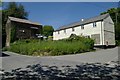
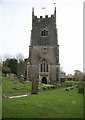
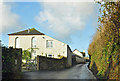
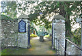
Photos of PL12 6NW


Area Information
The postcode PL12 6NW defines a specific residential cluster in Cornwall, covering an area of exactly 4.9 hectares. This compact size means daily life here involves a close-knit community feel where neighbours interact frequently. A total of 1,523 people call this postcode home, creating a neighbourhood that feels intimate yet established. The layout supports a density of 218 people per square kilometre, which explains why the area does not feel sparse but lacks the congestion of larger towns. Living in PL12 6NW offers a distinct lifestyle defined by its small scale rather than urban sprawl. You are looking at a residential environment where space is at a premium but quality of life remains high. The area serves as a contained hub within the wider Saltash and Devonside region. Your daily routine will likely centre on footpaths and local streets linking to nearby facilities. This postcode is not just a map reference but a functional living space for families and individuals seeking a grounded existence. The character of the area is shaped by these specific boundaries and its immediate relationship with surrounding transport links. You gain access to major services while maintaining the quietude associated with a small residential pocket. The house price dynamics and community structure are directly influenced by this limited footprint and its strategic location.
- Area Type
- Postcode
- Area Size
- 4.9 hectares
- Population
- 1523
- Population Density
- 218 people/km²
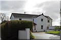
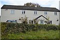
The housing market in PL12 6NW is characterised by stability and a strong preference for owner-occupancy. With 82% of residents owning their homes, this postcode functions primarily as an owner-occupied area rather than a rental hotspot. The accommodation type is exclusively houses, meaning you will not find flats or high-rise apartments within these specific boundaries. This single-family housing stock defines the visual character and planning constraints of the immediate neighbourhood. Buyers looking at homes in PL12 6NW should expect to encounter detached or semi-detached properties built for individual households. The low density of 218 people per square kilometre supports this house-focused market structure. Rental yields may exist but are secondary to the primary trend of long-term ownership. Properties here often feature gardens and private spaces suited to the 30–64 age demographic that dominates the area. When purchasing a home in this postcode, you are entering a market driven by resident investment rather than short-term letting agencies. The 4.9 hectare size of the area limits the volume of stock available, potentially making competition for specific properties keen. Sellers typically hold onto their assets for longer periods due to the desire to remain in the community. This market dynamic offers a secure environment for buyers who value continuity and local belonging over rapid property flipping. The high ownership rate also implies lower turnover rates, which can insulate prices from sudden bubbles or crashes driven by transient investors.
House Prices in PL12 6NW
Showing 2 properties
| Address | Type | Beds | Baths | Last Sale Price | Last Sale Date | |
|---|---|---|---|---|---|---|
| Smallacombe, Road From Bidwell Cottage To Elmsleigh, Carkeel, PL12 6NW | Detached | 8 | 4 | £735,000 | Oct 2020 | |
| Smallacombe Barn, Road From Bidwell Cottage To Elmsleigh, Carkeel, PL12 6NW | Flat | - | - | - | - |
Energy Efficiency in PL12 6NW
Residents of PL12 6NW enjoy excellent access to major retail and transport hubs within practical reach. Supermarkets like Waitrose Saltash, Lidl Saltash, and Iceland Saltash are located nearby, offering a wide variety of grocery options for your weekly shop. Commuters benefit from proximity to Saltash Railway Station, St Budeaux Victoria Road Railway Station, and St Budeaux Ferry Road Railway Station. These rail links provide direct connections to Plymouth and beyond, meaning your commute is straightforward. For those preferring sea travel, Torpoint Ferry Terminal, Devonport Ferry Terminal, and Cawsand Beach Ferry Landing Pier are available for ferry routes. You can reach Plymouth City Airport within a short distance if you have flying requirements. This connectivity ensures that living in PL12 6NW does not isolate you from the wider city network. Daily errands can be completed efficiently while maintaining a quiet residential base. The presence of these five retail venues, five rail stations, five ferry points, and one airport creates a convenient ecosystem around your home. You do not need to travel far to access essential services or leisure activities. The blend of convenient amenities and serviced transport links makes this postcode a practical choice for families who need nearby shopping but desire quiet surroundings. Planning your day allows you to visit these major sites without spending excessive time in traffic.
Amenities
Schools
| Rank | School | Type | Entry gender | Ages |
|---|
Explore more schools in this area
Go to Schools tabDemographics
The community in PL12 6NW is heavily weighted towards mature residents, with a median age of 47 years. Statistics confirm that the most common age range for those living here is between 30 and 64 years. This suggests a neighbourhood dominated by families with children, established professionals, and those entering retirement. Consequently, the area feels settled and stable rather than transient. Home ownership stands at an impressive 82%, indicating that the vast majority of residents own their properties outright or with a mortgage. This high level of ownership fosters investment in the local environment and long-term community bonds. Houses form the predominant accommodation type, fitting the architectural expectations of a Cornish residential zone. The population is predominantly White, reflecting the broader demographic trends of the region. Living in PL12 6NW means you are part of a community where generations have put down roots. Families often stay put in these properties rather than moving frequently. The age distribution supports local schools and community groups focused on youth and adult activities. You will find a quiet atmosphere where neighbours know each other well over decades. The lack of significant student housing or transient populations ensures consistent demand for local services. This demographic profile creates a predictable and secure environment for those seeking stability in their home life.
Household Size
Accommodation Type
Tenure
Ethnic Group
Religion
Household Composition
Age
Household Deprivation
NS-SEC
Explore more demographic insights in this area
Go to Demographics tabPlanning
Planning Constraints
- Flood RiskPremium
- Ramsar Wetland SitesPremium
- Area of Outstanding Natural BeautyPremium
- Protected Nature ReservePremium
- Protected WoodlandPremium