Area Overview for PL12 6FJ
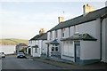
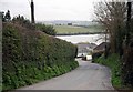
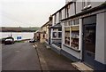
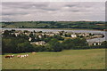
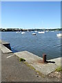
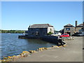
Photos of PL12 6FJ


Area Information
PL12 6FJ is a small residential cluster covering 1.6 hectares with a population of 1,474. Living in this postcode means you inhabit a tightly defined neighbourhood where daily life centres on the immediate surroundings of this specific location. The area sits comfortably within a low-density environment, where the nearest significant landmarks are defined by nearby service stations and transport nodes rather than dense urban infrastructure. You are surrounded by a community where houses dominate the landscape, creating a distinct separation from larger city centres. The character of PL12 6FJ is shaped by its isolation from major thoroughfares while maintaining practical access to key regional hubs like Saltash and Plymouth via rail and ferry links. Daily life here involves a reliance on clearly signposted routes and established transport corridors that connect the quiet streets of this 1.6-hectare enclave to the wider region. Owners in PL12 6FJ value the clear boundaries of their property and the absence of large-scale development pressures that typically characterise more congested areas. This postcode offers a settled lifestyle where residents enjoy a direct link to local amenities while benefiting from a residential setting that prioritises space and quiet over density.
- Area Type
- Postcode
- Area Size
- 1.6 hectares
- Population
- 1474
- Population Density
- 65 people/km²
The property market in PL12 6FJ is overwhelmingly dominated by owner-occupied homes, with 84% of the housing stock belonging to residents. This high ownership figure indicates that you are looking at an area where families have put down roots rather than a dynamic rental market for short-term tenants. Accommodation types consist exclusively of houses, meaning there are no flats or high-density blocks to consider. When buying homes in PL12 6FJ, you should expect to find standard detached or semi-detached properties typical of a rural or semi-rural setting. The small area size of 1.6 hectares constrains the total number of available properties, which often drives up competition for the limited stock. Because the area consists of houses rather than mixed-use developments, the local economy is likely to rely on residents commuting to nearby employment hubs rather than local office parks. Buyers should anticipate a market characterised by stability, where sales occur when owners retire or move up the property ladder rather than through large developer projects.
House Prices in PL12 6FJ
Showing 9 properties
| Address | Type | Beds | Baths | Last Sale Price | Last Sale Date | |
|---|---|---|---|---|---|---|
| 3 Park An Garrek, Cargreen, PL12 6FJ | house | - | - | £645,000 | Mar 2023 | |
| 9 Park An Garrek, Cargreen, PL12 6FJ | house | - | - | - | - | |
| 5 Park An Garrek, Cargreen, PL12 6FJ | house | - | - | - | - | |
| 1 Park An Garrek, Cargreen, PL12 6FJ | house | - | - | - | - | |
| 2 Park An Garrek, Cargreen, PL12 6FJ | house | - | - | - | - | |
| 4 Park An Garrek, Cargreen, PL12 6FJ | house | - | - | - | - | |
| 6 Park An Garrek, Cargreen, PL12 6FJ | house | - | - | - | - | |
| 7 Park An Garrek, Cargreen, PL12 6FJ | house | - | - | - | - | |
| 8 Park An Garrek, Cargreen, PL12 6FJ | house | - | - | - | - |
Energy Efficiency in PL12 6FJ
Living in PL12 6FJ places you within practical reach of a range of amenities that support daily life without requiring long journeys. Five railway stations stand within easy reach, including Bere Ferrers Railway Station, Saltash Railway Station, and Bere Alston Railway Station, offering flexible travel options for commuting or leisure. For shopping needs, you have access to five retail locations, specifically named Waitrose Saltash, Iceland Saltash, and Lidl Saltash, which provide groceries and essential goods. Transport links are further enhanced by two local airports and five ferry terminals, including Torpoint Ferry Terminal, Devonport Ferry Terminal, and Cawsand Beach Ferry Landing Pier. These connections allow you to access broader regional networks or international routes via ferry services. The combination of these named venues means you do not need to drive to distant city centres to handle routine errands or plan weekend trips. Your day-to-day convenience is supported by these specific, identifiable locations that are clearly signposted and accessible from the residential streets of PL12 6FJ.
Amenities
Schools
Families living in PL12 6FJ have access to Landulph School, which operates as both a primary institution and an academy. The academy rating from Ofsted is good, providing a clear indicator of educational quality for children growing up in this postcode. You will find two entries for Landulph School in the data, one designated as a primary school and the other as an academy, both sharing the same name and location profile. This mix allows for continuity in education for local children who stay within the same institution as they progress from younger years. The presence of a good-rated academy suggests that the local authority has invested in the facilities and curriculum to meet higher national standards. For parents considering homes in PL12 6FJ, the reliability of this local school means you do not need to travel far to secure an education that meets regulatory expectations. The school serves the immediate catchment area, reinforcing the community feel of the neighbourhood.
| Rank | School | Type | Entry gender | Ages |
|---|
Explore more schools in this area
Go to Schools tabDemographics
The community in PL12 6FJ is defined by a stable age profile where adults between 30 and 64 years constitute the most common age range. The median age stands at 47, indicating that you are likely to join a neighbourhood populated by mid-life families and established residents rather than students or retirees. This demographic consistency is reflected in an 84% home ownership rate, which confirms that the vast majority of residents live in the properties they purchased or inherited rather than renting. Houses are the sole predominant accommodation type, meaning you will find no apartment blocks or converted flats within this specific postcode. The ethnic makeup is predominantly White, aligning with the wider demographic trends of the local region. You are entering an area where long-term residency is the norm, as high ownership rates typically suggest deep roots in the community. The low population density of 65 people per square kilometre further supports a quiet environment where neighbours know each other by name. This demographic structure means you should expect a neighbourly atmosphere where community interaction is fostered through shared ownership and a common understanding of local priorities.
Household Size
Accommodation Type
Tenure
Ethnic Group
Religion
Household Composition
Age
Household Deprivation
NS-SEC
Explore more demographic insights in this area
Go to Demographics tabPlanning
Planning Constraints
- Flood RiskPremium
- Ramsar Wetland SitesPremium
- Area of Outstanding Natural BeautyPremium
- Protected Nature ReservePremium
- Protected WoodlandPremium