Area Overview for PL12 4UP
Photos of PL12 4UP
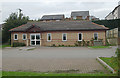
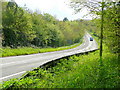
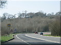

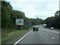
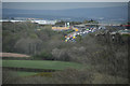
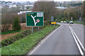
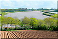

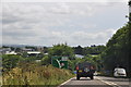
19 photos from this area
Area Information
Key information about the PL12 4UP including its size, population, and administrative classification.
- Area Type
- Postcode
- Area Size
- 2.2 hectares
- Population
- 1218
- Population Density
- 119 people/km²
House Prices in PL12 4UP
29
Properties
£199,954
Average Sold Price
£67,000
Lowest Price
£350,000
Highest Price
Showing 29 properties
| Address | Type | Beds | Baths | Last Sale Price | Last Sale Date | |
|---|---|---|---|---|---|---|
| 22 Leat View, Latchbrook, PL12 4UP | Detached | 3 | 3 | £345,000 | Jul 2025 | |
| 8 Leat View, Latchbrook, PL12 4UP | Detached | 4 | 2 | £350,000 | Oct 2023 | |
| 27 Leat View, Latchbrook, PL12 4UP | Detached | 4 | - | £285,000 | Oct 2018 | |
| 2 Leat View, Latchbrook, PL12 4UP | Detached | 4 | 1 | £257,000 | Sep 2018 | |
| 12 Leat View, Latchbrook, PL12 4UP | Detached | 3 | 2 | £258,000 | Jan 2018 | |
| 21 Leat View, Latchbrook, PL12 4UP | house | 4 | - | £284,000 | Mar 2017 | |
| 15 Leat View, Latchbrook, PL12 4UP | Detached | 4 | 2 | £282,000 | Jun 2016 | |
| 24 Leat View, Latchbrook, PL12 4UP | Detached | 4 | 4 | £274,000 | Dec 2015 | |
| 5 Leat View, Latchbrook, PL12 4UP | Detached | 3 | - | £175,000 | Nov 2012 | |
| 3 Leat View, Latchbrook, PL12 4UP | Detached | - | - | £249,950 | Nov 2007 |
Page 1 of 3
Energy Efficiency in PL12 4UP
Amenities
Schools
| Rank | School | Type | Entry gender | Ages |
|---|
Explore more schools in this area
Go to Schools tabDemographics
Household Size
Two person
most common
Accommodation Type
Houses
most common
Tenure
92
majority
Ethnic Group
White
most common
Religion
N/A
most common
Household Composition
N/A
most common
Age
47
median
Adults (30-64 years)
most common
Household Deprivation
N/A
with no deprivation
NS-SEC
42
in Lower managerial occupations
Explore more demographic insights in this area
Go to Demographics tabPlanning
Planning Constraints
- Flood RiskPremium
- Ramsar Wetland SitesPremium
- Area of Outstanding Natural BeautyPremium
- Protected Nature ReservePremium
- Protected WoodlandPremium