Area Overview for PL12 4HG
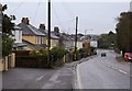
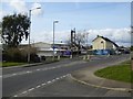
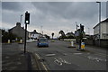
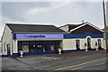
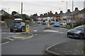
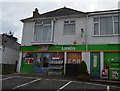
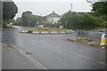
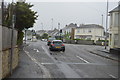
Photos of PL12 4HG


Area Information
Living in PL12 4HG offers a settled residential experience within a compact 1.4 hectare cluster. This specific postcode area accommodates a population of 1523, resulting in a population density of 218 people per square kilometre. The location suits those who prefer a contained neighbourhood while remaining close to broader urban centres. Daily life here revolves around established homes and quiet streets, away from the high traffic of major thoroughfares. The area is primarily defined by its residential nature, providing a stable environment for families and professionals alike. You will find that the community moves at a steady pace, supported by reliable local infrastructure. Prospective buyers should note that this small footprint creates a tight-knit atmosphere where neighbours often know one another. The position allows for easy access to nearby transport links and services without sacrificing privacy. Those seeking a home in this specific cluster appreciate the balance between space and convenience. The layout ensures that residents do not feel isolated from essential amenities while enjoying a distinct sense of place.
- Area Type
- Postcode
- Area Size
- 1.4 hectares
- Population
- 1523
- Population Density
- 218 people/km²
Homes in PL12 4HG are chiefly defined by their ownership status and physical form. The housing stock is overwhelmingly owner-occupied, which accounts for 82% of all properties in this postcode. This market structure suggests a stable environment where residents have their roots in the community. You will find that houses dominate the landscape, fitting the description of a residential cluster of detached or semi-detached dwellings. This contrasts with areas where flats or purpose-built apartments are common. The predominance of houses appeals to buyers seeking private gardens and traditional living spaces. When viewing properties in PL12 4HG, expect to see established buildings rather than new developments. The ownership rate of 82% implies that most sellers live there year-round, reducing the likelihood of vacant listings. This market dynamic can lead to stronger local networks between neighbours. For those searching for a home to stay in, the high ownership percentage is a positive indicator of community investment. The scarcity of flats in the immediate data reinforces the suburban feel of the property market here.
House Prices in PL12 4HG
Showing 10 properties
| Address | Type | Beds | Baths | Last Sale Price | Last Sale Date | |
|---|---|---|---|---|---|---|
| 74 Liskeard Road, Saltash, PL12 4HG | Detached | 5 | 4 | £495,000 | Oct 2023 | |
| 78 Liskeard Road, Saltash, PL12 4HG | house | 3 | - | £168,000 | Jun 2012 | |
| 80 Liskeard Road, Saltash, PL12 4HG | Terraced | - | - | £120,000 | Aug 2006 | |
| 58 Liskeard Road, Saltash, PL12 4HG | Semi-detached | 3 | 1 | - | - | |
| 1, Ploughboy Mews, Liskeard Road, Saltash, PL12 4HG | Detached | - | - | - | - | |
| 2, Ploughboy Mews, Liskeard Road, Saltash, PL12 4HG | house | - | - | - | - | |
| Managers Accommodation At, Ploughboy Inn, 60 Liskeard Road, Saltash, PL12 4HG | Flat | - | - | - | - | |
| 3, Ploughboy Mews, Liskeard Road, Saltash, PL12 4HG | house | - | - | - | - | |
| 4, Ploughboy Mews, Liskeard Road, Saltash, PL12 4HG | Detached | - | - | - | - | |
| 82 Liskeard Road, Saltash, PL12 4HG | Terraced | - | - | - | - |
Energy Efficiency in PL12 4HG
Residents of PL12 4HG enjoy convenient access to a range of practical amenities within practical reach. Five retail units operate nearby, including Spar, Lidl Saltash, and Iceland Saltash. These superstores and local shops provide essential grocery options and daily necessities without requiring long journeys. You will find five railway stations close by, such as Saltash Railway Station and St Budeaux Victoria Road Railway Station, offering excellent links to wider Devon and Cornwall. Three ferry terminals are also available, including Torpoint Ferry Terminal and Cawsand Beach Ferry Landing Pier, facilitating travel across the River Tamar. Two airports serve the region, with Plymouth City Airport listed for both local and regional flights. This variety of transport options gives you flexibility in how you commute or travel for leisure. The presence of these five retail outlets ensures you can manage weekly shopping easily. Residents benefit from multiple rail and ferry connections, making road travel less critical for daily commutes. This diverse amenity mix supports a lifestyle that balances suburban comfort with regional accessibility.
Amenities
Schools
| Rank | School | Type | Entry gender | Ages |
|---|
Explore more schools in this area
Go to Schools tabDemographics
The community in PL12 4HG reflects a mature and stable demographic profile. The median age stands at 47, indicating that most residents fall within the thirty to sixty-four year age range. This suggests a neighbourhood populated by established families, professionals with careers, and empty nesters rather than young single tenants. You should expect a high level of home ownership, with 82% of dwellings in your name. This figure confirms that the area is dominated by owner-occupied households rather than private or social rentals. Most people living in this postcode reside in houses, reinforcing the character of the stock as family-oriented rather than dense urban apartments. The predominant ethnic group is White, aligning with the broader patterns of the surrounding coastal regions. For anyone considering homes in PL12 4HG, the data paints a picture of a settled, non-transient community. The lack of significant youth or retirement populations means street life relies on working-age adults. This demographic stability contributes to consistent local governance and long-term community engagement. Buyers looking for a permanent residence will find the resident base matches their likely demographics.
Household Size
Accommodation Type
Tenure
Ethnic Group
Religion
Household Composition
Age
Household Deprivation
NS-SEC
Explore more demographic insights in this area
Go to Demographics tabPlanning
Planning Constraints
- Flood RiskPremium
- Ramsar Wetland SitesPremium
- Area of Outstanding Natural BeautyPremium
- Protected Nature ReservePremium
- Protected WoodlandPremium