Area Overview for PL12 4EB
Photos of PL12 4EB
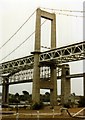
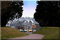
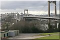
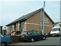
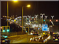

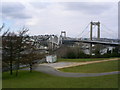


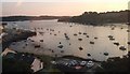

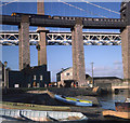
100 photos from this area
Area Information
Key information about the PL12 4EB including its size, population, and administrative classification.
- Area Type
- Postcode
- Area Size
- 9435 m²
- Population
- 1690
- Population Density
- 4273 people/km²
House Prices in PL12 4EB
17
Properties
£277,675
Average Sold Price
£158,000
Lowest Price
£374,000
Highest Price
Showing 17 properties
| Address | Type | Beds | Baths | Last Sale Price | Last Sale Date | |
|---|---|---|---|---|---|---|
| 19 Albert Road, Saltash, PL12 4EB | Bungalow | 2 | 1 | £305,000 | Oct 2024 | |
| 11 Albert Road, Saltash, PL12 4EB | Detached | 5 | 2 | £355,000 | Sep 2020 | |
| Moorings, 23 Albert Road, Saltash, PL12 4EB | Detached | 3 | 1 | £365,000 | Nov 2019 | |
| 38 Albert Road, Saltash, PL12 4EB | Maisonette | 2 | - | £275,000 | Dec 2018 | |
| 21 Albert Road, Saltash, PL12 4EB | Detached | 4 | - | £374,000 | May 2018 | |
| 17 Albert Road, Saltash, PL12 4EB | Semi-detached | 2 | - | £192,500 | Sep 2017 | |
| 15 Albert Road, Saltash, PL12 4EB | Detached | 3 | 1 | £220,000 | May 2017 | |
| 40 Albert Road, Saltash, PL12 4EB | Semi-detached | 3 | 1 | £158,000 | Apr 2017 | |
| 25 Albert Road, Saltash, PL12 4EB | Bungalow | 2 | - | £252,250 | Oct 2016 | |
| 44 Albert Road, Saltash, PL12 4EB | house | 4 | - | £280,000 | Jun 2013 |
Page 1 of 2
Energy Efficiency in PL12 4EB
Amenities
Schools
| Rank | School | Type | Entry gender | Ages |
|---|
Explore more schools in this area
Go to Schools tabDemographics
Household Size
One person
most common
Accommodation Type
Houses
most common
Tenure
61
majority
Ethnic Group
White
most common
Religion
N/A
most common
Household Composition
N/A
most common
Age
47
median
Adults (30-64 years)
most common
Household Deprivation
N/A
with no deprivation
NS-SEC
34
in Lower managerial occupations
Explore more demographic insights in this area
Go to Demographics tabPlanning
Planning Constraints
- Flood RiskPremium
- Ramsar Wetland SitesPremium
- Area of Outstanding Natural BeautyPremium
- Protected Nature ReservePremium
- Protected WoodlandPremium