Area Overview for PL12 4AZ
Photos of PL12 4AZ
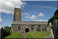
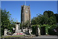
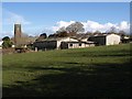
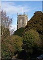
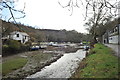
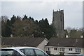
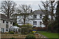
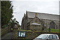
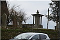
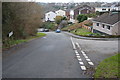

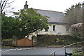
60 photos from this area
Area Information
Key information about the PL12 4AZ including its size, population, and administrative classification.
- Area Type
- Postcode
- Area Size
- 1.0 hectares
- Population
- 1416
- Population Density
- 4883 people/km²
House Prices in PL12 4AZ
24
Properties
£117,531
Average Sold Price
£35,499
Lowest Price
£238,000
Highest Price
Showing 24 properties
| Address | Type | Beds | Baths | Last Sale Price | Last Sale Date | |
|---|---|---|---|---|---|---|
| 6 Briansway, St Stephens, PL12 4AZ | Terraced | 3 | 1 | £220,000 | Mar 2024 | |
| 12 Briansway, St Stephens, PL12 4AZ | Terraced | 3 | 1 | £170,000 | Jan 2018 | |
| 18 Briansway, St Stephens, PL12 4AZ | Terraced | 3 | 1 | £166,000 | May 2017 | |
| 1 Briansway, St Stephens, PL12 4AZ | Detached | 4 | - | £238,000 | Apr 2015 | |
| 2 Briansway, St Stephens, PL12 4AZ | Terraced | - | - | £164,950 | Nov 2004 | |
| 28 Briansway, St Stephens, PL12 4AZ | Bungalow | - | - | £128,500 | Dec 2002 | |
| 4 Briansway, St Stephens, PL12 4AZ | Terraced | - | - | £92,500 | Jul 2002 | |
| First Floor Flat, 26 Briansway, St Stephens, PL12 4AZ | Flat | - | - | £35,499 | Jun 2001 | |
| 22 Briansway, St Stephens, PL12 4AZ | house | - | - | £69,950 | Mar 2001 | |
| 20 Briansway, St Stephens, PL12 4AZ | Terraced | - | - | £57,500 | Feb 2000 |
Page 1 of 3
Energy Efficiency in PL12 4AZ
Amenities
Schools
| Rank | School | Type | Entry gender | Ages |
|---|
Explore more schools in this area
Go to Schools tabDemographics
Household Size
Two person
most common
Accommodation Type
Houses
most common
Tenure
71
majority
Ethnic Group
White
most common
Religion
N/A
most common
Household Composition
N/A
most common
Age
47
median
Adults (30-64 years)
most common
Household Deprivation
N/A
with no deprivation
NS-SEC
29
in Lower managerial occupations
Explore more demographic insights in this area
Go to Demographics tabPlanning
Planning Constraints
- Flood RiskPremium
- Ramsar Wetland SitesPremium
- Area of Outstanding Natural BeautyPremium
- Protected Nature ReservePremium
- Protected WoodlandPremium