Area Overview for PL11 3JH
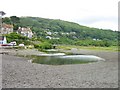
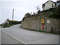
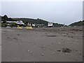
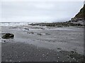
Photos of PL11 3JH


Area Information
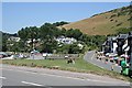
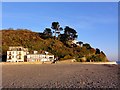
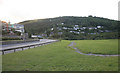
PL11 3JH represents a specific residential cluster on the Cornish coast, covering an area of exactly 4.0 hectares. This small footprint supports a population of 2,181 people, resulting in a very low density of 72 people per square kilometre. You live in a space that prioritises quiet over noise, striking a balance between coastal isolation and practical accessibility. The postcode serves as a residential hub where daily life moves at a measured pace, yet it remains connected to broader regional services. Residents benefit from a manageable scale that allows for close-knit community interactions without the overwhelming bustle of larger urban centres. This area offers a distinct character defined by its limited size and high proportion of home ownership. The compact nature of 4.0 hectares means you traverse your local environment quickly, whether walking to a shop or simply enjoying a neighbourhood stroll. Living in PL11 3JH provides a tangible sense of stability within a larger coastal context, appealing to those seeking a grounded existence away from city centres. The population density ensures that while you have neighbours nearby, there is ample space to appreciate the coastal setting. This postcode encapsulates a lifestyle focused on simplicity, security, and a deep connection to the immediate physical surroundings of the area.
- Area Type
- Postcode
- Area Size
- 4.0 hectares
- Population
- 2181
- Population Density
- 72 people/km²
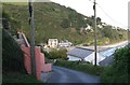
Homes in PL11 3JH are overwhelmingly characterised by single-family dwellings rather than high-density flats or apartments. The accommodation type data confirms that houses dominate the local housing stock, catering to those who prefer ground-level living or detached family environments. With 79 per cent of households recording as owner-occupied, the property market here functions less as a rental investment zone and more as a family settlement area. You are looking at an environment where properties have likely been passed down or accumulated over generations, contributing to the low population density of 72 people per square kilometre. This high home ownership rate implies that many properties are well-maintained and fit for residents who plan to stay in the area for the long term. The housing mix excludes the vertical living found in city centres, meaning your options focus on traditional house designs. This scarcity of flats aligns with the area's nature as a specific postcode cluster rather than a major urban expansion zone. Buyers here should expect to compete in a market driven by local demand and coastal appeal rather than short-term rental yields. The prevalence of houses also suggests that maintenance and exterior upkeep are visible community standards. You are entering a market where the asset is both a home and a stake in the local community structure.
House Prices in PL11 3JH
Showing 26 properties
| Address | Type | Beds | Baths | Last Sale Price | Last Sale Date | |
|---|---|---|---|---|---|---|
| Chy Noweth, Keveral Gardens, Seaton, PL11 3JH | Detached | 3 | 1 | £272,000 | Nov 2024 | |
| Wiscombe, 9 Keveral Gardens, Seaton, PL11 3JH | Detached | 4 | 2 | £375,000 | Mar 2024 | |
| Amalyn, Keveral Gardens, Seaton, PL11 3JH | Semi-detached | 5 | 1 | £350,000 | Aug 2023 | |
| Lansethen, Keveral Gardens, Seaton, PL11 3JH | Detached | 4 | 2 | £450,000 | Jun 2023 | |
| Malmo, 7 Keveral Gardens, Seaton, PL11 3JH | Bungalow | 2 | 1 | £325,000 | Sep 2021 | |
| 16 Keveral Gardens, Seaton, PL11 3JH | Bungalow | - | - | £325,000 | Dec 2020 | |
| 1, Brookside, Keveral Gardens, Seaton, PL11 3JH | Flat | 4 | 3 | £115,000 | Jan 2020 | |
| 2, Brookside, Keveral Gardens, Seaton, PL11 3JH | Flat | 2 | 1 | £115,000 | Jan 2020 | |
| Roseleigh, Keveral Gardens, Seaton, PL11 3JH | Detached | 1 | 2 | £302,500 | Dec 2019 | |
| 12 Keveral Gardens, Seaton, PL11 3JH | Bungalow | 2 | 1 | £212,500 | Jun 2018 |
Energy Efficiency in PL11 3JH
Living in PL11 3JH offers immediate access to essential retail and transport hubs without significant travel times. The area is situated near five retail outlets, including Spar, Co-op Looe, and Co-op East. These specific venues provide daily necessities such as groceries and household items within easy reach. Your convenience relies on these named shops, which serve the local population of 2,181. For commuting, rail connectivity is strong with five stations noted in immediate practical reach. Looe Railway Station, Sandplace Railway Station, and St Germans Railway Station form your nearest rail options. You can access regional networks from these stations to move beyond the 4.0 hectares of your local postcode. The footpath or walk to Looe or St Germans should be short given the proximity of these five stations to the area. This mix of shops and trains creates a lifestyle that balances coastal serenity with urban utility. You have the freedom to choose between a quiet day at home or an easy trip to a station. The specific names of the amenities ensure that you know exactly where to go for your weekly shop or train ticket. No guesswork is required when accessing these named facilities.
Amenities
Schools
Families living in PL11 3JH have access to education facilities within practical reach, primarily centred around one main establishment. St Nicolas CofE VA School in Downderry serves the area as both a primary school and an academy. The school holds a specific Ofsted rating of Good, which is a regulated standard for educational quality in England. You have two options listed for this single entity, one focusing on the primary phase and the other on its academy status. This concentration of provision means parents do not need to look far beyond their immediate neighbourhood for early education. The school caters to younger children, aligning well with the adult-dominated demographic of the postcode. There is no data provided for secondary institutions in the immediate vicinity, so the local provision is focused entirely on primary and academy-level continuity. Living in PL11 3JH means your child's education begins at a verified facility with a positive regulatory standing. The presence of a Good-rated academy near Downderry provides a structured learning environment within the community. This setup supports families who value immediate access to compulsory education without reliance on distant transport networks for younger years.
| Rank | School | Type | Entry gender | Ages |
|---|
Explore more schools in this area
Go to Schools tabDemographics
The community within PL11 3JH is led by adults aged 30 to 64 years old and relies heavily on home ownership. Seventy-nine per cent of residents own their homes, placing this postcode firmly in the owner-occupier bracket. This figure leaves only 21 per cent of the population in rental accommodation, indicating a deeply established resident base rather than a transient population. The predominant ethnic group identifies as White, reflecting the traditional demographic makeup of many coastal towns in the region. Your neighbours fall into the mature age bracket, which often correlates with the high rate of home ownership and a desire for stability. This demographic profile suggests a community that values privacy and long-term settlement over the fast-paced life typical of younger commuter belts. The age skew creates an atmosphere where family life and settled careers are central themes. You are joining a neighbourhood where people have put down roots, and where the half of the population under 30 is likely comprised of student populations or long-term residents still coming of age. Living in PL11 3JH means engaging with a demographic that has the economic means to be homeowners and the demographic maturity to prioritise communal stability. The lack of significant youth population in the median core reinforces a quieter, perhaps slightly older, residential dynamic.
Household Size
Accommodation Type
Tenure
Ethnic Group
Religion
Household Composition
Age
Household Deprivation
NS-SEC
Explore more demographic insights in this area
Go to Demographics tabPlanning
Planning Constraints
- Flood RiskPremium
- Ramsar Wetland SitesPremium
- Area of Outstanding Natural BeautyPremium
- Protected Nature ReservePremium
- Protected WoodlandPremium