Area Overview for PL11 3JA
Photos of PL11 3JA
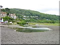
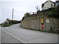


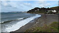
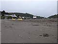
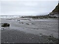
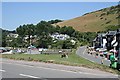
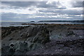
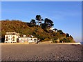
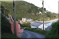
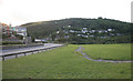
41 photos from this area
Area Information
Key information about the PL11 3JA including its size, population, and administrative classification.
- Area Type
- Postcode
- Area Size
- 29.9 hectares
- Population
- 2181
- Population Density
- 72 people/km²
House Prices in PL11 3JA
53
Properties
£623,512
Average Sold Price
£30,000
Lowest Price
£2,000,000
Highest Price
Showing 53 properties
| Address | Type | Beds | Baths | Last Sale Price | Last Sale Date | |
|---|---|---|---|---|---|---|
| Sea Fever, Brenton Road, Downderry, PL11 3JA | Detached | 4 | 2 | £625,000 | Oct 2024 | |
| Mortegh, Brenton Road, Downderry, PL11 3JA | house | - | - | £660,000 | Oct 2024 | |
| Sunnyside, Brenton Road, Downderry, PL11 3JA | Detached | 5 | 3 | £1,100,000 | Dec 2023 | |
| Crows Nest, Brenton Road, Downderry, PL11 3JA | Detached | 3 | 3 | £1,110,000 | Nov 2023 | |
| Cliff Side, Brenton Road, Downderry, PL11 3JA | Detached | 3 | 2 | £800,000 | Aug 2023 | |
| Swn-y-don, Brenton Road, Downderry, PL11 3JA | Bungalow | - | - | £475,000 | Nov 2022 | |
| Summer Court, Brenton Road, Downderry, PL11 3JA | Bungalow | 4 | 4 | £1,350,000 | Oct 2022 | |
| Penrose, Brenton Road, Downderry, PL11 3JA | Bungalow | 3 | 1 | £500,000 | Oct 2022 | |
| Pentillie, Brenton Road, Downderry, PL11 3JA | Bungalow | 3 | 1 | £385,000 | Oct 2022 | |
| Kia Mena, Brenton Road, Downderry, PL11 3JA | Bungalow | - | - | £725,000 | Apr 2022 |
Page 1 of 6
Energy Efficiency in PL11 3JA
Amenities
Schools
| Rank | School | Type | Entry gender | Ages |
|---|
Explore more schools in this area
Go to Schools tabDemographics
Household Size
Two person
most common
Accommodation Type
Houses
most common
Tenure
79
majority
Ethnic Group
White
most common
Religion
N/A
most common
Household Composition
N/A
most common
Age
47
median
Adults (30-64 years)
most common
Household Deprivation
N/A
with no deprivation
NS-SEC
46
in Lower managerial occupations
Explore more demographic insights in this area
Go to Demographics tabPlanning
Planning Constraints
- Flood RiskPremium
- Ramsar Wetland SitesPremium
- Area of Outstanding Natural BeautyPremium
- Protected Nature ReservePremium
- Protected WoodlandPremium