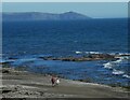
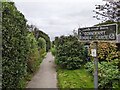
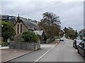
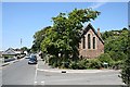
Area Overview for PL11 3FB
Photos of PL11 3FB


Area Information
Living in PL11 3FB offers a defined sense of place within the Looe postcodes. This specific postcode cluster covers an area of 1545 square metres and is home to 2181 residents. The population density registers at 72 people per square kilometre, indicating a relatively open residential environment rather than a dense urban concentration. You will find that this area functions as a small residential cluster where neighbours are within easy reach yet the space around properties remains distinct. The character of this postcode is shaped by its status as a specific planning unit rather than a large town centre or rural village outlier. Prospective buyers looking at homes in PL11 3FB should note that the location supports a settled community lifestyle. The footprint of this area provides enough space for gardens and outdoor living while maintaining proximity to essential services found further afield. It is a place where your daily walk to local shops feels manageable. The environment prioritises quiet residential streets over high-density development. This proximity to urban amenities combined with open space creates a practical living arrangement for families and individuals alike.
- Area Type
- Postcode
- Area Size
- 1545 m²
- Population
- 2181
- Population Density
- 72 people/km²
The housing landscape in PL11 3FB is characterised by a strong preference for independent living. Every available unit within this postcode is classified as a house, with no registered flats or apartments. This uniformity aligns perfectly with the 79 per cent home ownership rate, indicating a sale-to-let market that is predominantly occupied by families or long-term residents. Potential buyers looking at homes in PL11 3FB should expect traditional UK housing stock rather than new-build schemes or high-rise developments. The absence of rental-dominated blocks points away from a bustling student market or transient workforce. Instead, the area functions as a quiet residential zone where property transactions involve established dwellings. If you are considering purchasing a home here, your options will be limited to houses within this 1545 square metre footprint. The market reflects a desire for ground-level bedrooms and driveways rather than the convenience of shared corridors. This market structure ensures a predictable neighbourhood where the residents are primarily the owners of their properties.
House Prices in PL11 3FB
Showing 2 properties
| Address | Type | Beds | Baths | Last Sale Price | Last Sale Date | |
|---|---|---|---|---|---|---|
| Land At, 36 Buttlegate, Downderry, PL11 3FB | Detached | - | - | - | - | |
| Trewall House, Trewall Hill, Downderry, PL11 3FB | house | - | - | - | - |
Energy Efficiency in PL11 3FB
Your daily routine in PL11 3FB benefits from a compact range of practical amenities. There are five retail outlets within practical reach, providing essential shopping needs without long journeys. You can visit Waitrose Little for higher-end groceries, as well as local options such as Spar and Co-op Looe for daily necessities. These five stores ensure that routine errands remain quick and convenient. Transport links are robust given the availability of five nearby railway stations. St Germans Railway Station, Looe Railway Station, and Sandplace Railway Station are all reachable residents can utilise. This rail infrastructure allows you to reach further cities or coastal towns while remaining based in the quiet of PL11 3FB. The presence of these train stations connects you to wider networks while preserving a local feel. You do not need to drive frequently for basic transit needs if a train station is nearby. The blend of local shops and rail access creates a balanced lifestyle where independence meets connectivity.
Amenities
Schools
Families living in PL11 3FB have access to a single key educational institution situated nearby. St Nicolas CofE VA School, Downderry stands as the primary school of choice for younger children in the immediate vicinity. This same establishment also operates as an academy, offering a modern educational framework alongside its traditional church-linked heritage. The school holds a 'good' Ofsted rating, which provides a reliable benchmark for academic standards and care. You do not have multiple options listed for this specific postcode cluster, which suggests a reliance on this single provider for early years education. The single-school presence means that parents can anticipate a focused environment where the institution is a central hub for the community. There are no alternative primary or secondary schools listed within the direct data for PL11 3FB. This configuration is typical of small rural clusters where one school serves the entire catchment. If you need schools near PL11 3FB, St Nicolas CofE VA School, Downderry is the definitive answer provided by the available records.
| Rank | School | Type | Entry gender | Ages |
|---|
Explore more schools in this area
Go to Schools tabDemographics
The community within PL11 3FB is stabilised by a mature population profile. The median age is 47 years, which signals a neighbourhood dominated by established residents rather than transient youth. Most of the population falls within the 30 to 64 years age range, creating a demographic where homeowners are likely at various stages of building equity or maintaining existing properties. Home ownership stands at 79 per cent, making this primarily an owner-occupied area. This high rate suggests that many people have long-term roots in the neighbourhood and intend to stay for the foreseeable future. The accommodation type is exclusively houses, meaning you will not find flats or purpose-built blocks within this specific cluster. The predominant ethnic group is White, reflecting the established character of the village and its immediate surrounds. This demographic consistency contributes to a stable local governance engagement and community cohesion. With such a high proportion of owner-occupiers, the area appeals to those seeking a settled environment. The age profile supports a mix of active retirees and mid-life families who still wish to remain close to local schools and amenities.
Household Size
Accommodation Type
Tenure
Ethnic Group
Religion
Household Composition
Age
Household Deprivation
NS-SEC
Explore more demographic insights in this area
Go to Demographics tabPlanning
Planning Constraints
- Flood RiskPremium
- Ramsar Wetland SitesPremium
- Area of Outstanding Natural BeautyPremium
- Protected Nature ReservePremium
- Protected WoodlandPremium