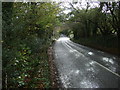
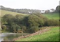
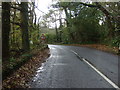
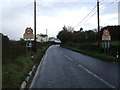
Area Overview for PL11 3EN
Photos of PL11 3EN
Area Information
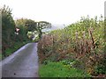
PL11 3EN represents a specific residential cluster covering 10.8 hectares in Cornwall, England, with a population of 2,181. This low density yields a figure of just 72 people per square kilometre, establishing a quiet, spacious living environment distinct from the denser towns nearby. You are looking at a小微 neighbourhood defined by its specific postcode rather than a formal village administration, which offers a sense of atmosphere without the congestion of larger settlements. The area caters to those seeking a balance between rural tranquility and access to regional services. Your daily life here is characterised by wide-open spaces and a community feel that develops naturally around the few hundred households in this postcode sector. It is a place where proximity to Atlantic coastlines and the historic towns of St Germans or Saltash defines your routine, rather than an immediate high-street surroundings. Living in PL11 3EN means embracing a slower pace while maintaining a reliable link to the rest of the county through established transport arteries.
- Area Type
- Postcode
- Area Size
- 10.8 hectares
- Population
- 2181
- Population Density
- 72 people/km²
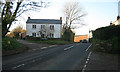
Homes in PL11 3EN form a market dominated by private ownership, evidenced by the fact that 79% of residents purchase their properties outright or with a mortgage rather than renting. This high ownership rate signals a stable, investment-oriented community where many families have settled permanently over many years. The accommodation type is exclusively houses, meaning you will not encounter apartment blocks or high-rise schemes typical of cities like Plymouth or London. This focus on detached or semi-detached properties appeals to buyers who prioritise garden space and privacy. Living in PL11 3EN means entering a market where traditional family homes hold significant value. The density of 72 people per kilometre squared ensures that properties remain spacious compared to the constrained layouts found in the postcodes of Saltash or St Budeaux. While the area lacks large-scale new developments, the consistency in housing types provides a predictable and uniform character for prospective buyers. Whether you are exchanging leasehold houses or freehold bungalows, the stock is tailored to the needs of established households.
House Prices in PL11 3EN
Showing 5 properties
| Address | Type | Beds | Baths | Last Sale Price | Last Sale Date | |
|---|---|---|---|---|---|---|
| Merlyn House, Georges Lane, Sheviock, PL11 3EN | Detached | 3 | 1 | £24,750 | Mar 2021 | |
| Cote Park House, Horsepool Lane, Sheviock, PL11 3EN | Detached | - | - | £97,500 | Apr 1999 | |
| The Pinetum, Horsepool Lane, Sheviock, PL11 3EN | Detached | 3 | - | - | - | |
| Marconhest, Horsepool Lane, Sheviock, PL11 3EN | house | - | - | - | - | |
| Crukies Corner, Georges Lane, Sheviock, PL11 3EN | Semi-detached | - | - | - | - |
Energy Efficiency in PL11 3EN
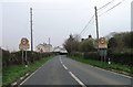
Your lifestyle in PL11 3EN is supported by a network of amenities within practical reach across the Cornwall region. Grocery shopping is convenient thanks to several options, including a Waitrose Little store and local Spar outlets, which are located nearby and handle the bulk of daily provisioning. For longer journeys, the area has five railway stations accessible for commuters, featuring St Germans Railway Station, Saltash Railway Station, and St Budeaux Victoria Road Railway Station from which to connect to Plymouth and beyond. Travelers can also utilise the ferry network, with landing points at Cawsand Beach Ferry Landing Pier, Torpoint Ferry Terminal, and Devonport Ferry Terminal providing links across the Tamar. Retail needs are well catered to with these local and regional choices available. While the immediate 10.8 hectares offer residential quiet, the broader St Germans and Saltash area provides the commercial vibrancy often missing from smaller postcodes. You do not need to travel far to reach established high streets or transport hubs.
Amenities
Schools
Families living in the vicinity of PL11 3EN have access to education facilities that demonstrate strong performance standards. The nearest specific institution is St Nicolas CofE VA School, located in Downderry. This school operates in both dual-tier capacity as a primary school and as an academy. Crucially, the academy status carries a 'Good' Ofsted rating, which serves as a marker of quality and reliability for parents. This specific rating confirms that educational standards meet the Department for Education's rigorous expectations for curriculum delivery and student outcomes. With children aged up to 64 present in the immediate demographic, you may find primary education is the most relevant requirement for this postcode. The presence of a rated academy within easy reach simplifies the search for schooling, removing the need to commute long distances to find a suitable institution. You can enrol your children in a local establishment without compromising on academic reputation.
| Rank | School | Type | Entry gender | Ages |
|---|
Explore more schools in this area
Go to Schools tabDemographics
The community within PL11 3EN is firmly anchored by mature residents, with a median age of 47 years. The most common age bracket comprises adults between 30 and 64 years, indicating a stable demographic where families with older children and retirees mix. This age profile suggests a neighbourhood where children have left home, yet the area retains a family-friendly character suitable for raising families as they move into their later years. A striking 79% of residents own their homes, highlighting that PL11 3EN is overwhelmingly an owner-occupied zone rather than a rental hub. This high level of ownership contrasts with urban locations where private renting dominates the housing stock. The population is predominantly White, reflecting a homogenous community with long-standing roots in the area. Housing stock consists almost entirely of houses, aligning perfectly with the preferences of the adult demographic and the high rate of homeownership. You are unlikely to find purpose-built flats or student accommodation in this section.
Household Size
Accommodation Type
Tenure
Ethnic Group
Religion
Household Composition
Age
Household Deprivation
NS-SEC
Explore more demographic insights in this area
Go to Demographics tabPlanning
Planning Constraints
- Flood RiskPremium
- Ramsar Wetland SitesPremium
- Area of Outstanding Natural BeautyPremium
- Protected Nature ReservePremium
- Protected WoodlandPremium