Area Overview for PL11 3AP
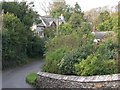
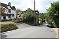
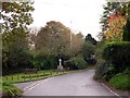
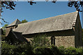
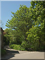
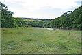
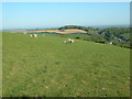
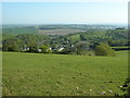
Photos of PL11 3AP


Area Information
Living in PL11 3AP means residing in a compact residential cluster across 1.4 hectares with a population of 1735. This postcode covers a small, defined area where the community is deeply interconnected. The location sits in a quiet setting that attracts those seeking space without the density of larger towns. You will find the atmosphere calm, shaped by a population density of 76 people per square kilometre. Daily life here revolves around the immediate neighbourhood and nearby coastal towns. The area functions as a self-contained pocket where neighbours often know one another. Your morning commute likely involves short drives to the coast rather than long journeys into city centres. The environment is defined by practicality, offering a slice of the countryside while maintaining access to essential services a short distance away. This small footprint creates a distinct character where every street corner holds local significance. You can traverse the entire area quickly, making it ideal for those who value proximity. The low density ensures a peaceful environment, yet the location connects you to wider networks via nearby transport hubs. PL11 3AP serves as a stable base for residents looking for a home that is both accessible and tranquil.
- Area Type
- Postcode
- Area Size
- 1.4 hectares
- Population
- 1735
- Population Density
- 76 people/km²
The property market in PL11 3AP is characterised by strong residential stability. Houses form the primary accommodation type, reflecting a stock designed for families seeking space and individual plots. A 71% home ownership rate indicates that the majority of these houses are freehold or leasehold properties owned by their residents. This creates a market where selling or renovation decisions happen occasionally rather than constantly. You are unlikely to find high-rise apartments or temporary rental units here. The housing stock consists of detached or semi-detached homes suited to the rural-edges setting of this 1.4-hectare area. Buying a home in this postcode means entering a quiet market with fewer transient buyers who move every few years. The dominance of houses means you can expect traditional British garden styles and driveway parking common in similar coastal locations. Buyers looking for this area should verify local planning constraints, such as the medium flood risk coverage noted for this sector. The owner-occupied nature suggests that residents invest financially in their homes, potentially stabilising prices against short-term fluctuations. Homes in PL11 3AP are typically bought for generational living rather as investment vehicles for quick turnover.
House Prices in PL11 3AP
Showing 8 properties
| Address | Type | Beds | Baths | Last Sale Price | Last Sale Date | |
|---|---|---|---|---|---|---|
| 4 Church Lane, St John, PL11 3AP | house | - | - | £375,000 | Jan 2021 | |
| Smoke Barn Cottage, Church Lane, St John, PL11 3AP | Semi-detached | 2 | 1 | £290,000 | May 2020 | |
| Smoke Barn House, Church Lane, St John, PL11 3AP | Detached | 4 | 2 | £525,000 | Sep 2014 | |
| Church Lane Cottage, 1 Church Lane, St John, PL11 3AP | Terraced | 3 | 2 | £280,000 | Apr 2011 | |
| Cherry Tree House, Church Lane, St John, PL11 3AP | Detached | - | - | - | - | |
| 1 Church Lane, St John, PL11 3AP | Terraced | - | - | - | - | |
| 3 Church Lane, St John, PL11 3AP | house | - | - | - | - | |
| Annes Cottage, Church Lane, St John, PL11 3AP | Bungalow | - | - | - | - |
Energy Efficiency in PL11 3AP
Your daily life in PL11 3AP centres on practical access to retail and leisure facilities. Five retail stores operate within reach, including the Co-op Millbrook, Spar, and Sainsburys Torpoint. These venues ensure you can manage weekly grocery shopping essentials without travelling far. The location of these supermarkets provides convenience for all households, from those buying clothes to parents purchasing baby food. Five ferry terminals add a unique leisure dimension to the lifestyle around PL11 3AP. Cawsand Beach Ferry Landing Pier, Torpoint Ferry Terminal, and Devonport Ferry Terminal allow quick trips across the River Tamar. Whether you want a seaside evening or a business meeting across the water, these facilities are a short drive away. Three railway stations, including Keyham Railway Station, offer another route if you need to reach wider commuting networks. The combination of local shops and coastal ferry access defines the rhythm of life here. You can walk to the local Spar from your home in PL11 3AP on a sunny afternoon. In the evening, you can drive to the beach or the terminal for a Saturday outing. This accessible range of amenities keeps the area functional while maintaining its rural charm.
Amenities
Schools
Families in PL11 3AP have several educational options nearby. Fourlanesend Community Primary School offers primary education with an Ofsted rating of satisfactory. You can find housing close to this school, which serves the immediate residential catchment for younger children. Another option is Antony Church of England School, which appears in the data as a primary institution. Beyond primary years, Antony Church of England School operates as an academy and holds a good Ofsted rating. This mix allows families to choose between different educational philosophies while remaining within a reasonable distance of PL11 3AP. The presence of a school with a good rating provides reassurance for children entering secondary or upper primary education. You might consider moving into homes in PL11 3AP specifically to access these local institutions without relying on transport to distant towns. The variety of school types, including community and academy structures, reflects a standard range of choices for local parents. When evaluating your commute to schools near PL11 3AP, consider that travel times will be short given the small population scale of the area.
| Rank | School | Type | Entry gender | Ages |
|---|
Explore more schools in this area
Go to Schools tabDemographics
The community in PL11 3AP reflects a mature family environment with a median age of 47 years. The most common age range spans adults between 30 and 64 years, indicating a settled population focused on stability. You will find that 71% of residents own their homes, creating a neighbourhood anchored by long-term homeowners rather than transient tenants. This high level of ownership typically results in quiet streets and well-maintained properties. Houses dominate the accommodation types, offering street-level detail and garden space that appeal to families. The predominant ethnic group is White, contributing to a culturally homogeneous community where local traditions likely run deep. This demographic profile suggests an area where children know their neighbours and local customs persist over generations. The age distribution implies a need for reliable, comfortable housing that suits older children and young adults. With fewer young families under 30, the area may cater more to established households than newcomers seeking a youthful energy. The 71% home ownership figure confirms this as a place for people who have chosen to put down roots. You will live among people who have a permanent stake in the local improvement of PL11 3AP.
Household Size
Accommodation Type
Tenure
Ethnic Group
Religion
Household Composition
Age
Household Deprivation
NS-SEC
Explore more demographic insights in this area
Go to Demographics tabPlanning
Planning Constraints
- Flood RiskPremium
- Ramsar Wetland SitesPremium
- Area of Outstanding Natural BeautyPremium
- Protected Nature ReservePremium
- Protected WoodlandPremium