Area Overview for PL11 2QJ
Photos of PL11 2QJ
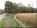
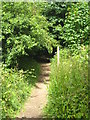
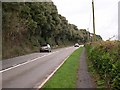
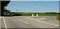
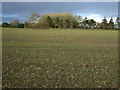
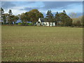
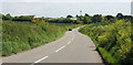
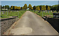
21 photos from this area
Area Information
Key information about the PL11 2QJ including its size, population, and administrative classification.
- Area Type
- Postcode
- Area Size
- 8.9 hectares
- Population
- 2161
- Population Density
- 856 people/km²
House Prices in PL11 2QJ
72
Properties
£166,566
Average Sold Price
£32,000
Lowest Price
£485,000
Highest Price
Showing 72 properties
| Address | Type | Beds | Baths | Last Sale Price | Last Sale Date | |
|---|---|---|---|---|---|---|
| 64 Lamorna Park, Torpoint, PL11 2QJ | Bungalow | 2 | 1 | £260,000 | Aug 2025 | |
| 39 Lamorna Park, Torpoint, PL11 2QJ | Semi-detached | 3 | 1 | £270,000 | Mar 2025 | |
| 41 Lamorna Park, Torpoint, PL11 2QJ | Detached | 4 | 3 | £450,000 | Oct 2023 | |
| 73 Lamorna Park, Torpoint, PL11 2QJ | Detached | 4 | 2 | £485,000 | Feb 2023 | |
| 45 Lamorna Park, Torpoint, PL11 2QJ | Semi-detached | 3 | 1 | £228,500 | Feb 2023 | |
| 70 Lamorna Park, Torpoint, PL11 2QJ | Detached | 4 | 2 | £445,000 | Jul 2022 | |
| 1 Lamorna Park, Torpoint, PL11 2QJ | Detached | 4 | 2 | £422,500 | May 2022 | |
| 67 Lamorna Park, Torpoint, PL11 2QJ | Retail | 3 | 1 | £325,000 | May 2022 | |
| 15 Lamorna Park, Torpoint, PL11 2QJ | Terraced | 2 | 1 | £150,000 | Oct 2021 | |
| 16 Lamorna Park, Torpoint, PL11 2QJ | house | 2 | 1 | £150,000 | Oct 2021 |
Page 1 of 8
Energy Efficiency in PL11 2QJ
Amenities
Schools
| Rank | School | Type | Entry gender | Ages |
|---|
Explore more schools in this area
Go to Schools tabDemographics
Household Size
Two person
most common
Accommodation Type
Houses
most common
Tenure
74
majority
Ethnic Group
White
most common
Religion
N/A
most common
Household Composition
N/A
most common
Age
47
median
Adults (30-64 years)
most common
Household Deprivation
N/A
with no deprivation
NS-SEC
31
in Lower managerial occupations
Explore more demographic insights in this area
Go to Demographics tabPlanning
Planning Constraints
- Flood RiskPremium
- Ramsar Wetland SitesPremium
- Area of Outstanding Natural BeautyPremium
- Protected Nature ReservePremium
- Protected WoodlandPremium