Area Overview for PL11 2NN
Photos of PL11 2NN
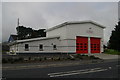
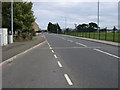
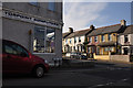
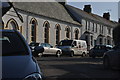
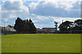

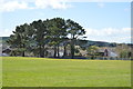
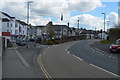
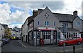

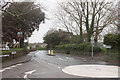
54 photos from this area
Area Information
Key information about the PL11 2NN including its size, population, and administrative classification.
- Area Type
- Postcode
- Area Size
- 1.7 hectares
- Population
- 1515
- Population Density
- 5248 people/km²
House Prices in PL11 2NN
25
Properties
£259,650
Average Sold Price
£88,000
Lowest Price
£375,000
Highest Price
Showing 25 properties
| Address | Type | Beds | Baths | Last Sale Price | Last Sale Date | |
|---|---|---|---|---|---|---|
| Orchard Cottage, Carbeile Road, Torpoint, PL11 2NN | Detached | - | - | £270,000 | Feb 2025 | |
| 92 Carbeile Road, Torpoint, PL11 2NN | Semi-detached | 3 | 1 | £250,000 | Apr 2023 | |
| 98 Carbeile Road, Torpoint, PL11 2NN | Bungalow | 4 | 2 | £341,000 | Nov 2021 | |
| 109 Carbeile Road, Torpoint, PL11 2NN | Detached | - | - | £350,000 | Sep 2021 | |
| 99 Carbeile Road, Torpoint, PL11 2NN | house | 4 | - | £375,000 | Aug 2021 | |
| 111A Carbeile Road, Torpoint, PL11 2NN | house | - | - | £290,000 | Mar 2010 | |
| 105 Carbeile Road, Torpoint, PL11 2NN | Semi-detached | - | - | £217,500 | Jan 2007 | |
| 96 Carbeile Road, Torpoint, PL11 2NN | Semi-detached | - | - | £165,000 | Jun 2006 | |
| Anneth Lowen, Carbeile Road, Torpoint, PL11 2NN | house | - | - | £250,000 | Nov 2003 | |
| 107 Carbeile Road, Torpoint, PL11 2NN | Bungalow | 3 | 1 | £88,000 | Feb 2000 |
Page 1 of 3
Energy Efficiency in PL11 2NN
Amenities
Schools
| Rank | School | Type | Entry gender | Ages |
|---|
Explore more schools in this area
Go to Schools tabDemographics
Household Size
One person
most common
Accommodation Type
Houses
most common
Tenure
77
majority
Ethnic Group
White
most common
Religion
N/A
most common
Household Composition
N/A
most common
Age
47
median
Adults (30-64 years)
most common
Household Deprivation
N/A
with no deprivation
NS-SEC
28
in Lower managerial occupations
Explore more demographic insights in this area
Go to Demographics tabPlanning
Planning Constraints
- Flood RiskPremium
- Ramsar Wetland SitesPremium
- Area of Outstanding Natural BeautyPremium
- Protected Nature ReservePremium
- Protected WoodlandPremium