Area Overview for PL11 2LH
Photos of PL11 2LH
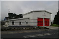
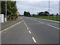
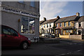
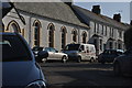
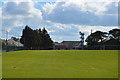

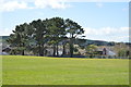
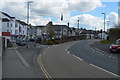
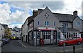

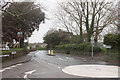
54 photos from this area
Area Information
Key information about the PL11 2LH including its size, population, and administrative classification.
- Area Type
- Postcode
- Area Size
- 5901 m²
- Population
- 1515
- Population Density
- 5248 people/km²
House Prices in PL11 2LH
25
Properties
£143,969
Average Sold Price
£40,500
Lowest Price
£325,000
Highest Price
Showing 25 properties
| Address | Type | Beds | Baths | Last Sale Price | Last Sale Date | |
|---|---|---|---|---|---|---|
| 6 Moor View, Torpoint, PL11 2LH | Terraced | 2 | 1 | £190,000 | May 2025 | |
| 7 Moor View, Torpoint, PL11 2LH | Terraced | 4 | 1 | £148,500 | Feb 2025 | |
| 11 Moor View, Torpoint, PL11 2LH | Terraced | 3 | 1 | £175,000 | Nov 2022 | |
| 1 Moor View, Torpoint, PL11 2LH | house | - | - | £285,000 | Jun 2022 | |
| 17B Moor View, Torpoint, PL11 2LH | Flat | - | - | £83,000 | Aug 2021 | |
| 9A Moor View, Torpoint, PL11 2LH | Flat | - | - | £108,500 | Mar 2019 | |
| 1B Moor View, Torpoint, PL11 2LH | Bungalow | 4 | 1 | £325,000 | Jul 2018 | |
| 4 Moor View, Torpoint, PL11 2LH | Terraced | 2 | 1 | £158,000 | Nov 2016 | |
| 17 Moor View, Torpoint, PL11 2LH | Land | - | - | £86,000 | Mar 2015 | |
| 13 Moor View, Torpoint, PL11 2LH | Terraced | 3 | - | £142,500 | Jun 2014 |
Page 1 of 3
Energy Efficiency in PL11 2LH
Amenities
Schools
| Rank | School | Type | Entry gender | Ages |
|---|
Explore more schools in this area
Go to Schools tabDemographics
Household Size
One person
most common
Accommodation Type
Houses
most common
Tenure
77
majority
Ethnic Group
White
most common
Religion
N/A
most common
Household Composition
N/A
most common
Age
47
median
Adults (30-64 years)
most common
Household Deprivation
N/A
with no deprivation
NS-SEC
28
in Lower managerial occupations
Explore more demographic insights in this area
Go to Demographics tabPlanning
Planning Constraints
- Flood RiskPremium
- Ramsar Wetland SitesPremium
- Area of Outstanding Natural BeautyPremium
- Protected Nature ReservePremium
- Protected WoodlandPremium