Area Overview for PL11 2HE
Photos of PL11 2HE
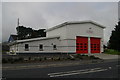
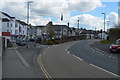
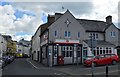

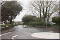
54 photos from this area
Area Information
Key information about the PL11 2HE including its size, population, and administrative classification.
- Area Type
- Postcode
- Area Size
- 6628 m²
- Population
- 1515
- Population Density
- 5248 people/km²
House Prices in PL11 2HE
32
Properties
£150,834
Average Sold Price
£16,350
Lowest Price
£235,000
Highest Price
Showing 32 properties
| Address | Type | Beds | Baths | Last Sale Price | Last Sale Date | |
|---|---|---|---|---|---|---|
| 6 Victoria Street, Torpoint, PL11 2HE | Terraced | 3 | 1 | £205,000 | Dec 2024 | |
| 17 Victoria Street, Torpoint, PL11 2HE | house | 3 | - | £235,000 | Nov 2021 | |
| 22 Victoria Street, Torpoint, PL11 2HE | house | - | - | £210,000 | Nov 2021 | |
| 24 Victoria Street, Torpoint, PL11 2HE | Terraced | 3 | - | £200,000 | Apr 2021 | |
| 2 Victoria Street, Torpoint, PL11 2HE | house | - | - | £155,000 | Nov 2020 | |
| 18 Victoria Street, Torpoint, PL11 2HE | Terraced | 3 | - | £140,000 | Oct 2020 | |
| 11 Victoria Street, Torpoint, PL11 2HE | Terraced | 3 | 2 | £152,500 | Dec 2017 | |
| 21 Victoria Street, Torpoint, PL11 2HE | Terraced | 3 | - | £161,000 | Jul 2016 | |
| 7 Victoria Street, Torpoint, PL11 2HE | Terraced | 3 | - | £157,000 | Nov 2013 | |
| 13 Victoria Street, Torpoint, PL11 2HE | Terraced | 3 | - | £164,000 | Aug 2013 |
Page 1 of 4
Energy Efficiency in PL11 2HE
Amenities
Schools
| Rank | School | Type | Entry gender | Ages |
|---|
Explore more schools in this area
Go to Schools tabDemographics
Household Size
One person
most common
Accommodation Type
Houses
most common
Tenure
77
majority
Ethnic Group
White
most common
Religion
N/A
most common
Household Composition
N/A
most common
Age
47
median
Adults (30-64 years)
most common
Household Deprivation
N/A
with no deprivation
NS-SEC
28
in Lower managerial occupations
Explore more demographic insights in this area
Go to Demographics tabPlanning
Planning Constraints
- Flood RiskPremium
- Ramsar Wetland SitesPremium
- Area of Outstanding Natural BeautyPremium
- Protected Nature ReservePremium
- Protected WoodlandPremium