Area Overview for PL11 2BL
Photos of PL11 2BL
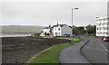
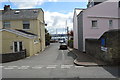
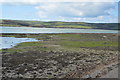
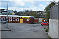
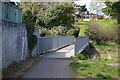
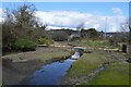
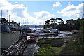
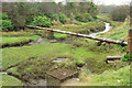
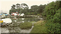
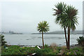
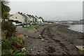
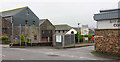
40 photos from this area
Area Information
Key information about the PL11 2BL including its size, population, and administrative classification.
- Area Type
- Postcode
- Area Size
- 7049 m²
- Population
- 1515
- Population Density
- 5248 people/km²
House Prices in PL11 2BL
17
Properties
£264,071
Average Sold Price
£63,000
Lowest Price
£760,000
Highest Price
Showing 17 properties
| Address | Type | Beds | Baths | Last Sale Price | Last Sale Date | |
|---|---|---|---|---|---|---|
| 17 St James Road, Torpoint, PL11 2BL | Terraced | 3 | 2 | £230,000 | Jul 2022 | |
| Tor House, 1 St James Road, Torpoint, PL11 2BL | Detached | 8 | 4 | £760,000 | Jun 2021 | |
| 24 St James Road, Torpoint, PL11 2BL | house | - | - | £410,000 | Dec 2020 | |
| 21 St James Road, Torpoint, PL11 2BL | house | - | - | £114,500 | Jan 2009 | |
| 19 St James Road, Torpoint, PL11 2BL | Terraced | - | - | £160,000 | Dec 2005 | |
| 27 St James Road, Torpoint, PL11 2BL | house | - | - | £63,000 | Nov 1999 | |
| 28 St James Road, Torpoint, PL11 2BL | Terraced | - | - | £111,000 | Nov 1997 | |
| 12A St James Road, Torpoint, PL11 2BL | Terraced | - | - | - | - | |
| Ground Floor Flat, 25 St James Road, Torpoint, PL11 2BL | Flat | - | - | - | - | |
| Tor Cottage, St James Road, Torpoint, PL11 2BL | Detached | - | - | - | - |
Page 1 of 2
Energy Efficiency in PL11 2BL
Amenities
Schools
| Rank | School | Type | Entry gender | Ages |
|---|
Explore more schools in this area
Go to Schools tabDemographics
Household Size
One person
most common
Accommodation Type
Houses
most common
Tenure
77
majority
Ethnic Group
White
most common
Religion
N/A
most common
Household Composition
N/A
most common
Age
47
median
Adults (30-64 years)
most common
Household Deprivation
N/A
with no deprivation
NS-SEC
28
in Lower managerial occupations
Explore more demographic insights in this area
Go to Demographics tabPlanning
Planning Constraints
- Flood RiskPremium
- Ramsar Wetland SitesPremium
- Area of Outstanding Natural BeautyPremium
- Protected Nature ReservePremium
- Protected WoodlandPremium