Area Overview for PL11 2AG
Photos of PL11 2AG

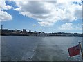
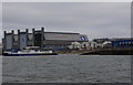
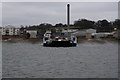


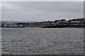


100 photos from this area
Area Information
Key information about the PL11 2AG including its size, population, and administrative classification.
- Area Type
- Postcode
- Area Size
- 5499 m²
- Population
- 1122
- Population Density
- 5555 people/km²
House Prices in PL11 2AG
18
Properties
-
Average Sold Price
-
Lowest Price
-
Highest Price
Showing 18 properties
| Address | Type | Beds | Baths | Last Sale Price | Last Sale Date | |
|---|---|---|---|---|---|---|
| Flat, 38 Fore Street, Torpoint, PL11 2AG | Maisonette | 1 | 1 | - | - | |
| The King's Arms, Kings Arms, 37 Fore Street, Torpoint, PL11 2AG | Maisonette | - | - | - | - | |
| Butterfly Kiss Beauty & Lashes, Fore Street, Torpoint, PL11 2AG | shop | - | - | - | - | |
| Devon And Cornwall Constabulary, Former Police Station, 4 Ferry Street, Torpoint, PL11 2AG | primary_healthcare | - | - | - | - | |
| Accommodation, 46 Fore Street, Torpoint, PL11 2AG | Maisonette | 1 | 1 | - | - | |
| Accommodation, 47 Fore Street, Torpoint, PL11 2AG | Flat | - | - | - | - | |
| The Forgotten Corner Drinks Company, Room 7, Discovery Court, Fore Street, Torpoint, PL11 2AG | Office | - | - | - | - | |
| Flat A, 46 Fore Street, Torpoint, PL11 2AG | Flat | - | - | - | - | |
| Flat B, 46 Fore Street, Torpoint, PL11 2AG | Flat | - | - | - | - | |
| Cornwall Council, The Old Fire Station, Fore Street, Torpoint, PL11 2AG | library_museum_gallery | - | - | - | - |
Page 1 of 2
Energy Efficiency in PL11 2AG
Amenities
Schools
| Rank | School | Type | Entry gender | Ages |
|---|
Explore more schools in this area
Go to Schools tabDemographics
Household Size
One person
most common
Accommodation Type
Houses
most common
Tenure
49
majority
Ethnic Group
White
most common
Religion
N/A
most common
Household Composition
N/A
most common
Age
47
median
Adults (30-64 years)
most common
Household Deprivation
N/A
with no deprivation
NS-SEC
22
in Lower managerial occupations
Explore more demographic insights in this area
Go to Demographics tabPlanning
Planning Constraints
- Flood RiskPremium
- Ramsar Wetland SitesPremium
- Area of Outstanding Natural BeautyPremium
- Protected Nature ReservePremium
- Protected WoodlandPremium