Area Overview for PL1 5RL
Photos of PL1 5RL
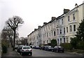
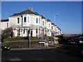
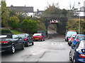
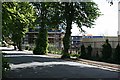

100 photos from this area
Area Information
Key information about the PL1 5RL including its size, population, and administrative classification.
- Area Type
- Postcode
- Area Size
- 1.3 hectares
- Population
- 1659
- Population Density
- 4578 people/km²
House Prices in PL1 5RL
23
Properties
£226,333
Average Sold Price
£65,000
Lowest Price
£340,000
Highest Price
Showing 23 properties
| Address | Type | Beds | Baths | Last Sale Price | Last Sale Date | |
|---|---|---|---|---|---|---|
| 20 Nelson Avenue, Plymouth, PL1 5RL | Terraced | 3 | 1 | £292,000 | Sep 2025 | |
| 18 Nelson Avenue, Plymouth, PL1 5RL | Detached | 3 | 2 | £320,000 | Jul 2025 | |
| 15 Nelson Avenue, Plymouth, PL1 5RL | Terraced | 3 | 1 | £340,000 | Nov 2022 | |
| 16 Nelson Avenue, Plymouth, PL1 5RL | house | 3 | 2 | £315,000 | Mar 2022 | |
| 10 Nelson Avenue, Plymouth, PL1 5RL | Terraced | 3 | 2 | £252,000 | Feb 2020 | |
| 5 Nelson Avenue, Plymouth, PL1 5RL | Semi-detached | 3 | 1 | £280,000 | Nov 2019 | |
| 21 Nelson Avenue, Plymouth, PL1 5RL | Terraced | 3 | 2 | £250,000 | Aug 2019 | |
| 23 Nelson Avenue, Plymouth, PL1 5RL | Terraced | 3 | 2 | £230,000 | Mar 2017 | |
| 22 Nelson Avenue, Plymouth, PL1 5RL | Terraced | 3 | 1 | £211,000 | Dec 2015 | |
| 9 Nelson Avenue, Plymouth, PL1 5RL | Detached | 3 | 1 | £180,000 | Aug 2014 |
Page 1 of 3
Energy Efficiency in PL1 5RL
Amenities
Schools
| Rank | School | Type | Entry gender | Ages |
|---|
Explore more schools in this area
Go to Schools tabDemographics
Household Size
One person
most common
Accommodation Type
Houses
most common
Tenure
65
majority
Ethnic Group
White
most common
Religion
N/A
most common
Household Composition
N/A
most common
Age
47
median
Adults (30-64 years)
most common
Household Deprivation
N/A
with no deprivation
NS-SEC
41
in Lower managerial occupations
Explore more demographic insights in this area
Go to Demographics tabPlanning
Planning Constraints
- Flood RiskPremium
- Ramsar Wetland SitesPremium
- Area of Outstanding Natural BeautyPremium
- Protected Nature ReservePremium
- Protected WoodlandPremium