Area Overview for PL1 5NF
Photos of PL1 5NF
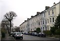
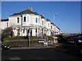
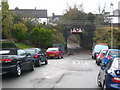
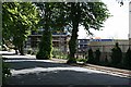
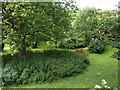

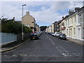

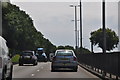
100 photos from this area
Area Information
Key information about the PL1 5NF including its size, population, and administrative classification.
- Area Type
- Postcode
- Area Size
- 7897 m²
- Population
- 1723
- Population Density
- 4179 people/km²
House Prices in PL1 5NF
54
Properties
£154,999
Average Sold Price
£42,500
Lowest Price
£261,000
Highest Price
Showing 54 properties
| Address | Type | Beds | Baths | Last Sale Price | Last Sale Date | |
|---|---|---|---|---|---|---|
| 69 Hotham Place, Plymouth, PL1 5NF | Terraced | 2 | 1 | £213,500 | Aug 2025 | |
| 37 Hotham Place, Plymouth, PL1 5NF | Terraced | 2 | 1 | £261,000 | Jul 2025 | |
| 32 Hotham Place, Plymouth, PL1 5NF | Terraced | 2 | 1 | £245,000 | Jan 2025 | |
| 62 Hotham Place, Plymouth, PL1 5NF | Terraced | 2 | 1 | £210,000 | Dec 2024 | |
| 46 Hotham Place, Plymouth, PL1 5NF | Terraced | 2 | 1 | £246,000 | Nov 2024 | |
| 71 Hotham Place, Plymouth, PL1 5NF | Terraced | 2 | 1 | £190,000 | Feb 2024 | |
| 76 Hotham Place, Plymouth, PL1 5NF | Terraced | 3 | 2 | £242,500 | Oct 2023 | |
| 36 Hotham Place, Plymouth, PL1 5NF | house | 3 | 1 | £260,000 | May 2023 | |
| 72 Hotham Place, Plymouth, PL1 5NF | house | - | - | £180,000 | Dec 2021 | |
| 61 Hotham Place, Plymouth, PL1 5NF | house | - | - | £176,000 | Oct 2021 |
Page 1 of 6
Energy Efficiency in PL1 5NF
Amenities
Schools
| Rank | School | Type | Entry gender | Ages |
|---|
Explore more schools in this area
Go to Schools tabDemographics
Household Size
One person
most common
Accommodation Type
Houses
most common
Tenure
53
majority
Ethnic Group
White
most common
Religion
N/A
most common
Household Composition
N/A
most common
Age
47
median
Adults (30-64 years)
most common
Household Deprivation
N/A
with no deprivation
NS-SEC
34
in Lower managerial occupations
Explore more demographic insights in this area
Go to Demographics tabPlanning
Planning Constraints
- Flood RiskPremium
- Ramsar Wetland SitesPremium
- Area of Outstanding Natural BeautyPremium
- Protected Nature ReservePremium
- Protected WoodlandPremium