Area Overview for PL1 4GP
Photos of PL1 4GP
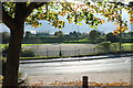
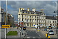
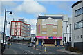
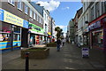
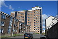
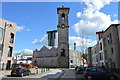
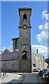
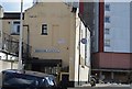
100 photos from this area
Area Information
Key information about the PL1 4GP including its size, population, and administrative classification.
- Area Type
- Postcode
- Area Size
- 5467 m²
- Population
- 2379
- Population Density
- 13426 people/km²
House Prices in PL1 4GP
34
Properties
£155,693
Average Sold Price
£86,500
Lowest Price
£235,000
Highest Price
Showing 34 properties
| Address | Type | Beds | Baths | Last Sale Price | Last Sale Date | |
|---|---|---|---|---|---|---|
| 97 Wall Street, Plymouth, PL1 4GP | house | - | - | £220,000 | Oct 2025 | |
| 41 Wall Street, Plymouth, PL1 4GP | Terraced | 3 | 1 | £132,000 | Mar 2025 | |
| 25 Wall Street, Plymouth, PL1 4GP | Terraced | 4 | 2 | £235,000 | Mar 2024 | |
| 47 Wall Street, Plymouth, PL1 4GP | Flat | - | - | £116,000 | Oct 2023 | |
| 95 Wall Street, Plymouth, PL1 4GP | Terraced | 2 | 2 | £192,500 | Mar 2023 | |
| 45 Wall Street, Plymouth, PL1 4GP | Flat | 1 | 1 | £105,000 | Jul 2022 | |
| 51 Wall Street, Plymouth, PL1 4GP | Flat | 1 | 1 | £110,000 | Jul 2022 | |
| 87 Wall Street, Plymouth, PL1 4GP | house | - | - | £220,000 | Sep 2021 | |
| 23 Wall Street, Plymouth, PL1 4GP | Terraced | 4 | 1 | £195,000 | Feb 2021 | |
| 103 Wall Street, Plymouth, PL1 4GP | Terraced | 3 | 2 | £205,000 | Dec 2020 |
Page 1 of 4
Energy Efficiency in PL1 4GP
Amenities
Schools
| Rank | School | Type | Entry gender | Ages |
|---|
Explore more schools in this area
Go to Schools tabDemographics
Household Size
One person
most common
Accommodation Type
Flats
most common
Tenure
36
majority
Ethnic Group
White
most common
Religion
N/A
most common
Household Composition
N/A
most common
Age
47
median
Adults (30-64 years)
most common
Household Deprivation
N/A
with no deprivation
NS-SEC
24
in Lower managerial occupations
Explore more demographic insights in this area
Go to Demographics tabPlanning
Planning Constraints
- Flood RiskPremium
- Ramsar Wetland SitesPremium
- Area of Outstanding Natural BeautyPremium
- Protected Nature ReservePremium
- Protected WoodlandPremium