Area Overview for PL1 3NW
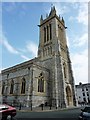
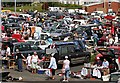
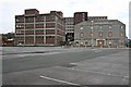
Photos of PL1 3NW


Area Information
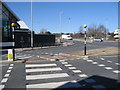
Living in PL1 3NW means residing in a compact residential cluster at the heart of Plymouth. This specific postcode covers an area of 2535 square metres and accommodates a population of 1178 residents. The location functions as a dense urban environment where space at ground level is limited, yet access to city services is immediate. You will find yourself surrounded by a high urban fabric where the majority of dwellings are flats rather than detached or semi-detached homes. The demographic profile reflects a settled population, with the median age sitting at 47 years. This suggests a community dominated by adults between the ages of 30 and 64 who likely have established careers or family ties. Daily life here is defined by proximity to the dual carriageways and termini that serve the city. Residents benefit from immediate Vicinity to major transport hubs, including Plymouth Railway Station and the central ferry terminals. While the area is small in physical footprint, it connects directly to the wider metropolitan infrastructure without the need for extensive travel to reach shops or offices. The local neighbourhood thrives on its integration with the broader Plymouth urban core.
- Area Type
- Postcode
- Area Size
- 2535 m²
- Population
- 1178
- Population Density
- 4573 people/km²
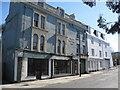
The housing stock in PL1 3NW is defined almost entirely by flat accommodation. This type of dwelling aligns with the dense urban setting of a specific postcode area covering such a limited geographical footprint. With only 33% of households owning their properties, the market is predominantly composed of rental units. This dynamic creates a specific buyer profile; those looking for a flat in this location are likely purchasing for investment purposes or as a second home rather than as a primary long-term residence for a single family. The low ownership rate compared to the high population density suggests a vibrant lettings market. Buyers should expect properties to be smaller in footprint, suited to single professionals or couples rather than large families. The absence of protected woodland or nature reserves means the immediate environment is strictly built-up. Consequently, prices per square metre will be influenced by the scarcity of land rather than expansive outdoor grounds. Your search for homes in PL1 3NW will yield a consistent style of urban living focused on vertical storage and city access rather than private grounds.
House Prices in PL1 3NW
Showing 1 properties
| Address | Type | Beds | Baths | Last Sale Price | Last Sale Date | |
|---|---|---|---|---|---|---|
| The Phoenix Tavern, 11 Phoenix Street, Plymouth, PL1 3NW | Leisure | - | - | - | - |
Energy Efficiency in PL1 3NW
Residents of PL1 3NW enjoy immediate access to a wide range of essential amenities without the need to travel far. Five retail outlets serve the daily shopping needs of the community, with notable options including Aldi Plymouth, Lidl Central, and Co-op Wilton. These supermarkets are convenient for weekly groceries and household necessities. Leisure and transport diversions are also vibrant, backed by five ferry landing sites and five railway stations located in the immediate vicinity. Commuters can access Plymouth Railway Station directly, while leisure travellers can head to Plymouth Ferry Terminal or Royal William Yard Ferry Landing. Aviation enthusiasts have two airports to choose from, specifically Plymouth City Airport, which handles regional flights. While the area lacks distinct parks or protected natural reserves mentioned in the assessments, the urban infrastructure is robust. The concentration of transport nodes suggests a lifestyle centred on movement and connectivity. For those drawn to city living, the presence of Lidl Central and Aldi Plymouth ensures no shortage of fresh food or household goods. This amenity density supports a fast-paced urban routine.
Amenities
Schools
| Rank | School | Type | Entry gender | Ages |
|---|
Explore more schools in this area
Go to Schools tabDemographics
The community within PL1 3NW is characterised by a mature workforce and a significant reliance on rented accommodation. Data indicates that 33% of residents own their homes personally, meaning the majority live in the private rental sector. This high rental proportion suggests the area attracts professional tenants and those seeking flexibility in Plymouth's competitive market. The population is 47% middleaged adults, with the most common age range falling between 30 and 64 years. This demographic cluster points towards a neighbourhood supported by families with children or retirees who have downsized to the city centre. White residents form the predominant ethnic group within this specific postcode sector. Conservation and planning constraints are notably absent, as there is no coverage of Ramsar wetland sites, Areas of Outstanding Natural Beauty, or protected woodlands. The very high population density figure underscores the urban intensity of this specific spot. For potential buyers, the lack of planning constraints typically allows for developments to proceed where permitted, while the age profile points towards stability rather than a transient student population.
Household Size
Accommodation Type
Tenure
Ethnic Group
Religion
Household Composition
Age
Household Deprivation
NS-SEC
Explore more demographic insights in this area
Go to Demographics tabPlanning
Planning Constraints
- Flood RiskPremium
- Ramsar Wetland SitesPremium
- Area of Outstanding Natural BeautyPremium
- Protected Nature ReservePremium
- Protected WoodlandPremium