Area Overview for PL1 3LP
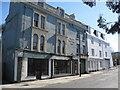
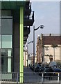
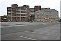
Photos of PL1 3LP


Area Information
Living in PL1 3LP means residing in a very compact residential cluster located within Plymouth, England. This specific postcode covers just 4,099 square metres, creating a dense living environment for the 1,178 people who call it home. The population density reaches an extreme 287,379 people per square kilometre, indicating a small, tightly packed neighbourhood rather than a sprawling suburb. You are situated in a micro-community where daily life revolves around the immediate vicinity due to the limited physical space. The area sits in a primarily urban context, distinct from larger residential zones. With less than half a hectare of land, the layout is defined by its concentrated nature. This density influences the pace of daily life, offering quick proximity to essential services but also creating a walk-heavy environment. The small size of the area means that neighbourhood noise and activity are shared intimately among residents. When considering homes in PL1 3LP, you must account for the close quarters and the specific character that arises from such high density. It is a defined slice of Plymouth, separate enough to have its own metrics yet integrated into the wider city fabric.
- Area Type
- Postcode
- Area Size
- 4099 m²
- Population
- 1178
- Population Density
- 4573 people/km²
The property market in PL1 3LP is defined by its unusual concentration of rental flats rather than traditional owner-occupied family homes. With only 33 per cent home ownership in this postcode, the market is heavily skewed towards tenancy. This statistic indicates that potential buyers might find more difficulty acquiring property here compared to areas with higher ownership rates. The accommodation type data confirms that flats are the dominant housing form, which aligns perfectly with the dense, small-scale nature of the 4,099 square metre area. When examining homes in PL1 3LP, you should expect a stock consisting largely of comprising multiple units rather than individual detached houses. This type of housing is designed for the high population density of 287,379 people per square kilometre. The low ownership rate suggests a vibrant rental sector, possibly catering to the many adults aged 30 to 64 who reside here but do not own. For anyone looking to buy, this market profile means entering an environment where investment potential might rely on rental yields from the large tenant population. The mix is entirely factual: a small footprint, a predominantly adult population, and a housing stock that is mostly rented. There are no speculative elements here, just the clear data of a flat-dominant, tenant-heavy postcode. Buyers must understand that the supply is likely limited to flats given the strict geographical boundaries and the established nature of the 1,178 residents.
House Prices in PL1 3LP
Showing 26 properties
| Address | Type | Beds | Baths | Last Sale Price | Last Sale Date | |
|---|---|---|---|---|---|---|
| 3, Lower Ground Floor Flat 1, Victoria Place, Millbay Road, Plymouth, PL1 3LP | Flat | 2 | 1 | £113,500 | Mar 2023 | |
| 1 Victoria Place, Plymouth, PL1 3LP | house | - | - | £137,000 | Apr 2022 | |
| 5, Lower Ground Floor Front Flat, Victoria Place, Millbay Road, Plymouth, PL1 3LP | Flat | - | - | £75,000 | Aug 2020 | |
| 1A, Victoria Place, Millbay Road, Plymouth, PL1 3LP | Maisonette | 3 | 1 | - | - | |
| 2 Victoria Place, Plymouth, PL1 3LP | Flat | 2 | 1 | - | - | |
| 4, Lower Ground Floor Flat 1, Victoria Place, Millbay Road, Plymouth, PL1 3LP | Flat | 1 | 1 | - | - | |
| 4, Second Floor Flat, Victoria Place, Millbay Road, Plymouth, PL1 3LP | Flat | - | - | - | - | |
| 3, First Floor Flat, Victoria Place, Millbay Road, Plymouth, PL1 3LP | Flat | - | - | - | - | |
| 2F, Victoria Place, Millbay Road, Plymouth, PL1 3LP | Flat | - | - | - | - | |
| 4, First Floor Flat, Victoria Place, Millbay Road, Plymouth, PL1 3LP | Flat | - | - | - | - |
Energy Efficiency in PL1 3LP
Your lifestyle in PL1 3LP is heavily influenced by the wealth of transport hubs and retail options located just a short distance away. The nearest retail facilities include Aldi Plymouth, Lidl Central, and Tesco Devonport, ensuring you have access to major grocery chains and supermarkets without needing to travel far. These five retail locations provide daily necessities within practical reach of the 1,178 residents living in this small area. Transport connectivity is diverse, with five railway stations including Plymouth Railway Station and Devonport Railway Station nearby. There are also five ferry terminals such as Plymouth Ferry Terminal and Plymouth Stonehouse Ferry Terminal, offering extensive maritime connections. Two airports, both identified as Plymouth City Airport, are within reach, providing aviation options for travel. This peninsula location means you are surrounded by modes of transport that cover local, inter-city, and international travel needs. Five mentioned amenities in the retail category alone mean you are never short of shopping options. For residents of PL1 3LP, this translates to a life where shops, trains, and ferries are immediate neighbours. The convenience of having Aldi, Lidl, and Tesco so close supports a practical, independent lifestyle where daily errands are quick and accessible. The high number of transport links complements the lack of space in the postcode, offering easy exits from the dense living environment.
Amenities
Schools
| Rank | School | Type | Entry gender | Ages |
|---|
Explore more schools in this area
Go to Schools tabDemographics
The community in PL1 3LP has a distinctly mature demographic profile, with a median age of 47 years. Most residents fall into the adult age range between 30 and 64 years, suggesting a neighbourhood populated by working professionals or retired individuals rather than young families with children. This age structure often correlates with a quieter, more established community atmosphere compared to areas dominated by students or young professionals. Home ownership presents a significant reality for those living in PL1 3LP, with only 33 per cent of residents owning their homes. This implies that a substantial majority rent their accommodation, which can affect neighbourhood investment dynamics and local stability. The accommodation type is predominantly flats, fitting the high-density description of the postcode and the limited 4,099 square metre footprint. This high prevalence of flats is typical for compact urban locations where space is at a premium. Ethnically, White residents form the predominant group in this specific cluster. The demographic data paints a picture of a settled, adult population living in modern flat blocks. Living in PL1 3LP involves navigating a community where rental housing accounts for two-thirds of the houses and most residents are middle-aged adults. These specific figures define the social rhythm and potential buyer pool for the area.
Household Size
Accommodation Type
Tenure
Ethnic Group
Religion
Household Composition
Age
Household Deprivation
NS-SEC
Explore more demographic insights in this area
Go to Demographics tabPlanning
Planning Constraints
- Flood RiskPremium
- Ramsar Wetland SitesPremium
- Area of Outstanding Natural BeautyPremium
- Protected Nature ReservePremium
- Protected WoodlandPremium