Area Overview for PL1 3LD
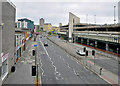
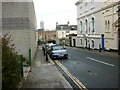
Photos of PL1 3LD


Area Information
Living in PL1 3LD defines a highly specific residential experience within a compact eight-and-a-quarter-thousand-square-metre cluster. This postcode serves approximately 1,457 people, creating a tight-knit environment where neighbours are inevitably familiar. The location sits at the heart of Plymouth, situated just minutes from key transport hubs and retail centres. You are surrounded by the practicalities of city life, yet the area retains the definition of a small, concentrated community. The defining characteristic of PL1 3LD is its density; with a population density of 176,535 people per square kilometre, the streets are occupied by occupants seeking urban convenience rather than sprawling green spaces. This intensity of occupancy means daily life revolves around immediate access to services and transport links. The area functions as a strategic node connecting residents to wider business districts, ferry terminals, and railway stations. When considering homes in PL1 3LD, you must accept that space is at a premium and the atmosphere is urban and direct. The area does not offer isolation; instead, it provides a grounded, accessible base for living in Plymouth. You will find yourself walking short distances to supermarkets, transport links, and local amenities. This proximity is the primary draw for anyone choosing this specific cluster over more expansive suburbs.
- Area Type
- Postcode
- Area Size
- 8253 m²
- Population
- 1457
- Population Density
- 4196 people/km²
The housing market in PL1 3LD is defined by a specific conversion of urban space into residential flats. With 45 per cent of residents owning their homes, the area represents a mixed economy of private ownership and significant rental stock. Flats are the primary form of accommodation, meaning buyers looking for traditional detached or semi-detached houses will not find them within CL1 3LD boundaries. This structure caters to professionals and investors who value density and location over traditional garden space. The high population density confirms that the site is fully developed, leaving little room for new construction or expansion. When searching for homes in PL1 3LD, your focus must be on multi-unit buildings and converted urban properties. The low total area size of 8,253 square metres dictates that each property counts for a significant portion of the neighbourhood's floor plan. You are entering a market where space is utilitarian and every square foot serves a residential purpose. This density makes the area attractive to those prioritising access over territory. The high volume of flats suggests a buyer pool rich in renters looking to exchange terms for equity, alongside existing owners selling within the same compact footprint. If you require a house with extensive outdoor space, this postcode is not the solution. Conversely, if you desire proximity to amenities and do not require private grounds, the flat-based stock of PL1 3LD offers the necessary utility.
House Prices in PL1 3LD
Showing 1 properties
| Address | Type | Beds | Baths | Last Sale Price | Last Sale Date | |
|---|---|---|---|---|---|---|
| The New Continental, New Continental Hotel, Millbay Road, Plymouth, PL1 3LD | hotel | - | - | - | - |
Energy Efficiency in PL1 3LD
Daily life in PL1 3LD offers immediate access to essential services and leisure options within walking distance. The area features five notable retail outlets, including Aldi Plymouth, Tesco Notte, and Iceland Plymouth, ensuring you can stock a kitchen or grab groceries without a long journey. Five ferry terminals, five railway stations, and two airports are located nearby, allowing for seamless travel connections. This concentration of transport hubs is unusual for a residential cluster and speaks to the strategic location of the postcode. You can easily reach Plymouth City Airport or the main terminal for long-distance travel from your doorstep. Leisure options are anchored by proximity to these major transport nodes, which often serve as market squares in themselves. While the area is dense with transport infrastructure, the retail provision ensures basic lifestyle needs are met locally. The presence of major supermarket chains like Tesco and Aldi indicates that standard shopping habits are supported fully. Residents can manage their fortnightly shop and daily coffee run without venturing far from PL1 3LD. The lifestyle is defined by convenience rather than quiet speculation. You will find the essentials you need for a functional life are present, even if the environment is busy. This practicality appeals to those who value time over exclusivity.
Amenities
Schools
Education options for families living in PL1 3LD are limited but defined by one specific provider nearby. The nearest educational institution is St Andrew's C of E VA Primary School, which holds a 'good' Ofsted rating. This single listing confirms that PL1 3LD itself is not a primary educational hub but acts as a residential base for the surrounding catchment area. The 'good' rating provides reassurance regarding the quality of education a child might receive while attending this primary school. However, the absence of secondary schools or further primary options in the immediate data suggests that most children in this postcode travel to other facilities for later education. You must investigate the specific catchment zone for St Andrew's to confirm eligibility from your exact property. The reliance on one nearby school indicates that the immediate neighbourhood is not a self-contained educational estate. Families choosing to live in PL1 3LD should be prepared to integrate their school planning with the wider Plymouth network. The presence of a rated primary school is a positive marker, but it does not constitute a full ecosystem of education within the postcode boundaries. For those with school-age children, the requirement to check travel distance and zoning becomes a critical step in the purchasing process for homes in PL1 3LD.
| Rank | School | Type | Entry gender | Ages |
|---|
Explore more schools in this area
Go to Schools tabDemographics
The community within PL1 3LD reflects a distinct shift towards later life stages, with a median age of 47 years. Most residents fall within the adult demographic of thirty to sixty-four years old, suggesting the street names are home to established households rather than young families or students. Home ownership stands at exactly 45 per cent, placing the area slightly below the national average for owner-occupancy. This figure indicates a balanced market where long-term residents coexist with those leasing their accommodation. Flats remain the predominant accommodation type, aligning with the high-density nature of the postcode. The ethnic composition is predominantly White, forming the backbone of the local population structure. While the area benefits from strong digital infrastructure, with a fixed broadband score of 88 and mobile coverage of 84, the social fabric is defined by this older, settled demographic. You are entering a neighbourhood where stability is common but the housing stock is largely rented or privately owned flats. The age profile means local interactions are likely centred on shared middle and older adulthood rather than typical family playgroups. Residents in PL1 3LD enjoy excellent connectivity, which supports remote work or commuting within the city. However, the home ownership rate suggests you are more likely to secure a tenancy than to buy your home immediately upon moving in.
Household Size
Accommodation Type
Tenure
Ethnic Group
Religion
Household Composition
Age
Household Deprivation
NS-SEC
Explore more demographic insights in this area
Go to Demographics tabPlanning
Planning Constraints
- Flood RiskPremium
- Ramsar Wetland SitesPremium
- Area of Outstanding Natural BeautyPremium
- Protected Nature ReservePremium
- Protected WoodlandPremium