Area Overview for PL1 3EU
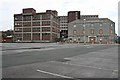
Photos of PL1 3EU


Area Information
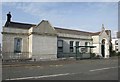
PL1 3EU represents a specific residential cluster within the broader Plymouth postcode area. This small neighbourhood hosts a population of 1178 people, creating a tight-knit environment where daily interactions are frequent. The area is defined by its concentrated housing stock rather than sprawling suburban development. Living in PL1 3EU means being part of a defined community block where residents share immediate proximity to key transport and retail hubs. The postcode covers a compact zone that prioritises accessibility over extensive green space. You can expect a high density of homes in close quarters. This density facilitates quick walks to essential services but requires navigation of narrow streets typical of established urban clusters. The area functions as a practical living zone for those seeking proximity to Plymouth's core without committing to the larger sprawl of Devonport or Stonehouse. Your daily commute will rely on short distances to major stations and terminals. The neighbourhood offers a straightforward proposition for buyers prioritising location efficiency.
- Area Type
- Postcode
- Area Size
- Not available
- Population
- 1178
- Population Density
- 4573 people/km²
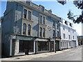
The property market in PL1 3EU is characterised by a heavy concentration of flats. Only 33 per cent of dwellings are owner-occupied, which signifies that rental properties outnumber owner-occupied homes significantly. This distribution shapes the local housing stock, prioritising multi-unit blocks over single-family residences. Buyers looking for homes in PL1 3EU must consider the implications of this rental-heavy landscape. The prevalence of flats suggests limited availability of detached or semi-detached properties. You should expect a market skewed towards flat purchases and lively tenancies. This structure appeals to young professionals and empty nesters who prefer low-maintenance living costs. The area does not cater to large families seeking standalone gardens or extensive grounds. Homeownership opportunities exist but represent the minority of transactions. If you seek an investment property, the high rental stock offers potential income streams. However, finding an owner-occupied flat to purchase presents a competitive challenge. The market dynamics reflect the 1178 resident population's needs. Your search for a family home in this postcode may require looking to adjacent zones. The 33 per cent ownership figure remains the defining statistic for buyer expectations.
House Prices in PL1 3EU
Showing 34 properties
| Address | Type | Beds | Baths | Last Sale Price | Last Sale Date | |
|---|---|---|---|---|---|---|
| 35 Durnford Street, Plymouth, PL1 3EU | Retail | 2 | 1 | £170,000 | Mar 2017 | |
| Flat 7, 31 Durnford Street, Plymouth, PL1 3EU | Flat | 2 | 1 | - | - | |
| Flat 25, 33 Durnford Street, Plymouth, PL1 3EU | Flat | 2 | 1 | - | - | |
| Flat 8, 31 Durnford Street, Plymouth, PL1 3EU | Flat | 1 | 1 | - | - | |
| Flat 17A, 33 Durnford Street, Plymouth, PL1 3EU | Maisonette | 2 | 1 | - | - | |
| Flat 2, 31 Durnford Street, Plymouth, PL1 3EU | Flat | 1 | - | - | - | |
| Flat 6, 31 Durnford Street, Plymouth, PL1 3EU | Flat | - | - | - | - | |
| Flat 1, 31 Durnford Street, Plymouth, PL1 3EU | Flat | 2 | - | - | - | |
| Flat 20, 33 Durnford Street, Plymouth, PL1 3EU | Flat | - | - | - | - | |
| Flat 28, 33 Durnford Street, Plymouth, PL1 3EU | Flat | - | - | - | - |
Energy Efficiency in PL1 3EU
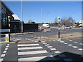
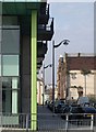
Residents of PL1 3EU benefit from immediate access to five major ferry terminals, including Plymouth Stonehouse Ferry Terminal and Plymouth Ferry Terminal. These links provide convenient connections to Exeter and other coastal towns. Your morning commute might involve a quick ferry hop or a train ride from Devonport Railway Station. Five retail outlets line the nearby streets, featuring Lidl Central, Aldi Plymouth, and Tesco Devonport for daily groceries. These supermarkets offer practical shopping solutions for those living in flats or rental properties. Two airports, identified as Plymouth City Airport, provide quick departure options for air travel. You can plan weekend trips to Cornwall or Cornwall without long drives. The area's retail and transport density ensures you rarely need a car for basic errands. Plymouth Railway Station and Dockyard Railway Station handle commuter traffic efficiently. Living in PL1 3EU means your daily routine centres around these five key amenity clusters. Travelers rely on Royal William Yard Ferry Landing for leisure crossings. The concentration of services reduces the need for extensive car ownership. You can manage household logistics entirely from footpaths and cycle routes.
Amenities
Schools
| Rank | School | Type | Entry gender | Ages |
|---|
Explore more schools in this area
Go to Schools tabDemographics
The community in PL1 3EU reflects a mature demographic profile with a median age of 47 years. Most families and individuals residing here fall into the adult age range between 30 and 64 years. You will find that households are dominated by working-age adults rather than retirees or young families. Home ownership stands at 33 per cent, meaning more than two-thirds of residents rely on renting their accommodation. This ratio indicates a dynamic rental market alongside a smaller base of owner-occupiers. The local population is predominantly White, aligning with the established character of the Plymouth region. Flats form the primary accommodation type within this postcode cluster. This housing form suits the age profile of residents who may value low-maintenance living over detached houses. The demographic data suggests a stable population of established adults. Thirty-three per cent ownership contrasts with the majority renting situation. This split influences local investment dynamics and tenant turnover rates. Understanding this age composition helps you gauge the likely school needs in the immediate vicinity. The area caters largely to established professionals and long-term tenants seeking stability.
Household Size
Accommodation Type
Tenure
Ethnic Group
Religion
Household Composition
Age
Household Deprivation
NS-SEC
Explore more demographic insights in this area
Go to Demographics tabPlanning
Planning Constraints
- Flood RiskPremium
- Ramsar Wetland SitesPremium
- Area of Outstanding Natural BeautyPremium
- Protected Nature ReservePremium
- Protected WoodlandPremium