Area Overview for PL1 3AS
Photos of PL1 3AS
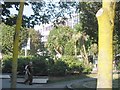
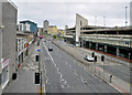
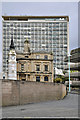
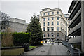
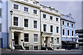
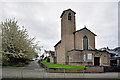
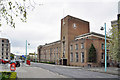
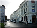
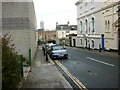

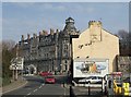
100 photos from this area
Area Information
Key information about the PL1 3AS including its size, population, and administrative classification.
- Area Type
- Postcode
- Area Size
- 2727 m²
- Population
- 1457
- Population Density
- 4196 people/km²
House Prices in PL1 3AS
45
Properties
£186,625
Average Sold Price
£42,000
Lowest Price
£400,000
Highest Price
Showing 45 properties
| Address | Type | Beds | Baths | Last Sale Price | Last Sale Date | |
|---|---|---|---|---|---|---|
| 11 St James Place East, Plymouth, PL1 3AS | Terraced | 5 | - | £400,000 | Sep 2025 | |
| 9 St James Place East, Plymouth, PL1 3AS | Terraced | 5 | - | £328,000 | Jun 2021 | |
| 8 St James Place East, Plymouth, PL1 3AS | Terraced | 4 | - | £189,000 | Oct 2013 | |
| 6 St James Place East, Plymouth, PL1 3AS | house | 5 | - | £210,000 | Feb 2011 | |
| 3 St James Place East, Plymouth, PL1 3AS | Terraced | - | - | £200,000 | Jun 2009 | |
| 1 St James Place East, Plymouth, PL1 3AS | Terraced | - | 1 | £75,000 | Apr 2005 | |
| 5 St James Place East, Plymouth, PL1 3AS | Unknown | - | 2 | £49,000 | Feb 1999 | |
| 2 St James Place East, Plymouth, PL1 3AS | house | - | - | £42,000 | Sep 1997 | |
| 4 St James Place East, Plymouth, PL1 3AS | Terraced | 8 | 4 | - | - | |
| (former) Ground Floor Flat, 2 St James Place East, Plymouth, PL1 3AS | Flat | - | - | - | - |
Page 1 of 5
Energy Efficiency in PL1 3AS
Amenities
Schools
| Rank | School | Type | Entry gender | Ages |
|---|
Explore more schools in this area
Go to Schools tabDemographics
Household Size
One person
most common
Accommodation Type
Flats
most common
Tenure
45
majority
Ethnic Group
White
most common
Religion
N/A
most common
Household Composition
N/A
most common
Age
47
median
Adults (30-64 years)
most common
Household Deprivation
N/A
with no deprivation
NS-SEC
34
in Lower managerial occupations
Explore more demographic insights in this area
Go to Demographics tabPlanning
Planning Constraints
- Flood RiskPremium
- Ramsar Wetland SitesPremium
- Area of Outstanding Natural BeautyPremium
- Protected Nature ReservePremium
- Protected WoodlandPremium