Area Overview for PL1 2NR
Photos of PL1 2NR

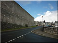
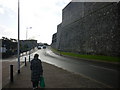
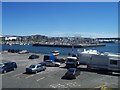
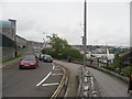

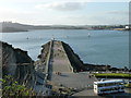
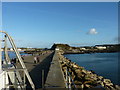
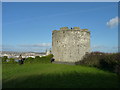
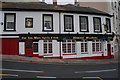

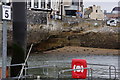
100 photos from this area
Area Information
Key information about the PL1 2NR including its size, population, and administrative classification.
- Area Type
- Postcode
- Area Size
- 3867 m²
- Population
- 2012
- Population Density
- 3669 people/km²
House Prices in PL1 2NR
18
Properties
£133,994
Average Sold Price
£66,000
Lowest Price
£185,000
Highest Price
Showing 18 properties
| Address | Type | Beds | Baths | Last Sale Price | Last Sale Date | |
|---|---|---|---|---|---|---|
| 63 Lambhay Hill, Plymouth, PL1 2NR | Flat | - | - | £174,000 | Feb 2020 | |
| 73 Lambhay Hill, Plymouth, PL1 2NR | Terraced | 4 | 1 | £185,000 | May 2019 | |
| 53 Lambhay Hill, Plymouth, PL1 2NR | Flat | - | - | £105,000 | Jun 2013 | |
| 55 Lambhay Hill, Plymouth, PL1 2NR | Flat | - | - | £110,000 | Mar 2012 | |
| 71 Lambhay Hill, Plymouth, PL1 2NR | Terraced | 3 | - | £175,000 | Dec 2008 | |
| 81 Lambhay Hill, Plymouth, PL1 2NR | Flat | - | - | £169,950 | Jun 2007 | |
| 77 Lambhay Hill, Plymouth, PL1 2NR | Flat | - | - | £81,000 | Jul 2002 | |
| 75 Lambhay Hill, Plymouth, PL1 2NR | Terraced | 3 | 2 | £140,000 | Sep 2001 | |
| 79 Lambhay Hill, Plymouth, PL1 2NR | Flat | - | - | £66,000 | Jun 2001 | |
| 61 Lambhay Hill, Plymouth, PL1 2NR | Flat | - | - | - | - |
Page 1 of 2
Energy Efficiency in PL1 2NR
Amenities
Schools
| Rank | School | Type | Entry gender | Ages |
|---|
Explore more schools in this area
Go to Schools tabDemographics
Household Size
One person
most common
Accommodation Type
Flats
most common
Tenure
26
majority
Ethnic Group
White
most common
Religion
N/A
most common
Household Composition
N/A
most common
Age
22
median
Young Adults (15-29 years)
most common
Household Deprivation
N/A
with no deprivation
NS-SEC
22
in Lower managerial occupations
Explore more demographic insights in this area
Go to Demographics tabPlanning
Planning Constraints
- Flood RiskPremium
- Ramsar Wetland SitesPremium
- Area of Outstanding Natural BeautyPremium
- Protected Nature ReservePremium
- Protected WoodlandPremium