Area Overview for PL1 2HU
Photos of PL1 2HU
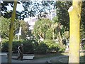
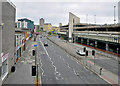


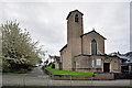


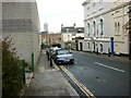


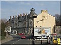
100 photos from this area
Area Information
Key information about the PL1 2HU including its size, population, and administrative classification.
- Area Type
- Postcode
- Area Size
- 2967 m²
- Population
- 2012
- Population Density
- 3669 people/km²
House Prices in PL1 2HU
23
Properties
£329,714
Average Sold Price
£65,000
Lowest Price
£685,000
Highest Price
Showing 23 properties
| Address | Type | Beds | Baths | Last Sale Price | Last Sale Date | |
|---|---|---|---|---|---|---|
| 165 Citadel Road, Plymouth, PL1 2HU | Semi-detached | 4 | 3 | £450,000 | Apr 2024 | |
| 171 Citadel Road, Plymouth, PL1 2HU | house | - | - | £685,000 | May 2021 | |
| 175 Citadel Road, Plymouth, PL1 2HU | Terraced | 4 | 6 | £460,000 | Aug 2019 | |
| 169 Citadel Road, Plymouth, PL1 2HU | Terraced | - | - | £125,000 | Sep 2015 | |
| 173 Citadel Road, Plymouth, PL1 2HU | house | 3 | - | £273,000 | Jun 2012 | |
| 179 Citadel Road, Plymouth, PL1 2HU | Flat | - | - | £250,000 | May 2011 | |
| 163 Citadel Road, Plymouth, PL1 2HU | house | - | - | £65,000 | Jul 2001 | |
| 167 Citadel Road, Plymouth, PL1 2HU | Terraced | 5 | 2 | - | - | |
| (former) Ground Floor, 163 Citadel Road, Plymouth, PL1 2HU | Flat | - | - | - | - | |
| (former), 169A Citadel Road, Plymouth, PL1 2HU | undefined | - | - | - | - |
Page 1 of 3
Energy Efficiency in PL1 2HU
Amenities
Schools
| Rank | School | Type | Entry gender | Ages |
|---|
Explore more schools in this area
Go to Schools tabDemographics
Household Size
One person
most common
Accommodation Type
Flats
most common
Tenure
26
majority
Ethnic Group
White
most common
Religion
N/A
most common
Household Composition
N/A
most common
Age
22
median
Young Adults (15-29 years)
most common
Household Deprivation
N/A
with no deprivation
NS-SEC
22
in Lower managerial occupations
Explore more demographic insights in this area
Go to Demographics tabPlanning
Planning Constraints
- Flood RiskPremium
- Ramsar Wetland SitesPremium
- Area of Outstanding Natural BeautyPremium
- Protected Nature ReservePremium
- Protected WoodlandPremium