Area Overview for Pilsdon
Photos of Pilsdon


Area Information
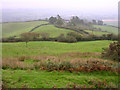
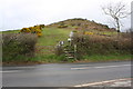
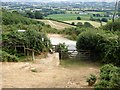
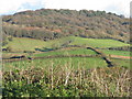
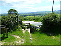
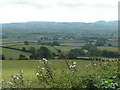
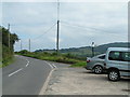
Pilsdon is a small civil parish located in Dorset, England, covering a total area of 2.7 square kilometres. This compact size defines the daily experience for everyone residing within these boundaries. The settlement offers a defined residential footprint where proximity between neighbourhood spots is inherent to the layout. You will find a community that operates at a manageable scale, avoiding the sprawl often found in larger districts. Living in Pilsdon means engaging with a tightly bounded environment where local amenities and housing clusters are close together. The geography restricts expansion, which often preserves the character of the built environment. Your daily commutes and walks will take place within a clearly delineated zone of 2.7 km². This specific area size influences how residents access local facilities and manage their movement between home and work. The parish status provides a level of local governance distinct from larger towns. You are stepping into a location where the physical limits are known and fixed. The land use is concentrated, ensuring that the distance between your home and the centre is short. This geographical concentration shapes the rhythm of life for all households here. The area remains distinct from surrounding rural zones due to these clear administrative boundaries. Your experience of Pilsdon is directly tied to this specific parcel of land in Dorset.
- Area Type
- Parish
- Area Size
- 2.7 km²
- Population
- Not available
- Population Density
- Not available
Demographics
The community in Pilsdon reflects a distinct demographic profile with a median age of 70 years. This figure indicates that the population is heavily weighted towards older residents. You are likely dealing with a settlement where longevity and retirement life dominate the social structure. The house ownership rate stands at 76%, a high proportion that points to a stable, long-term resident base. Most homes in Pilsdon are owned outright or with a mortgage, suggesting a lack of transient renting activity. This high level of home ownership typically correlates with residents who have deep local roots. Households in this parish are generally established rather than newly formed or transient. The accommodation types present a mixed picture but lean towards traditional housing suited for older generations. You can expect a neighbourhood where neighbours have known each other for decades. The age distribution confirms that children are a minority demographic within this specific parish. Every statistic provided highlights a static and settled community pattern. When you consider homes in Pilsdon, you are entering a domain managed primarily by an older demographic. The social fabric here is built on tenure stability rather than short-term tenancy agreements.
Household Size
Accommodation Type
Tenure
Ethnic Group
Religion
Household Composition
Age
Household Deprivation
NS-SEC
Explore more demographic insights in this area
Go to Demographics tabPlanning
Planning Constraints
- Flood RiskPremium
- Ramsar Wetland SitesPremium
- Area of Outstanding Natural BeautyPremium
- Protected Nature ReservePremium
- Protected WoodlandPremium
- Crime RiskPremium