Area Overview for Pill and Easton-in-Gordano
Photos of Pill and Easton-in-Gordano


Area Information
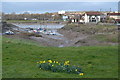
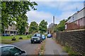
Pill and Easton-in-Gordano sits within the wider built-up area of Bristol in England. This residential zone spans just 1.4 km², creating a dense and compact environment where daily necessities and local spaces are in close proximity. The area functions as a distinct neighbourhood with a clear residential focus, offering a straightforward living experience without the sprawl of larger urban extensions. You will find a layout designed for traditional suburban life where the boundary between the immediate street and surrounding amenities is minimal. This compact footprint means that your walk to nearby facilities does not require extensive travel, allowing you to maintain a grounded connection with your immediate surroundings. Living in Pill and Easton-in-Gordano means embracing a neighbourhood that prioritises proximity over expansive green spaces or low-density housing. The physical scale of the area influences the pace of daily life, encouraging a rhythm that is local and community-oriented rather than dependent on long commutes to distant urban cores.
- Area Type
- Built Up Area 250
- Area Size
- 1.4 km²
- Population
- Not available
- Population Density
- Not available
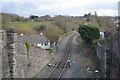
Residents of Pill and Easton-in-Gordano enjoy access to a variety of amenities within practical reach of their homes. Retail options are available through five nearby locations, including The Southern Co-operative Co, Spar Station Road, and Waitrose. These shops provide essential goods, offering convenience for daily shopping needs without requiring a car. For commuters, rail connectivity is supported by five stations, notably Shirehampton Railway Station, Portway Park & Ride Railway Station, and Avonmouth Railway Station. These stations offer straightforward links to the wider transport network. Ferry services are also accessible via five landing points, such as Bristol Docks Ferry Landing, Portishead Pier, and Nova Scotia Ferry Landing, adding a maritime dimension to your travel options. Bristol Filton Airport stands as the sole named airport facility in the vicinity. This combination of rail and sea transport creates a multi-modal environment, giving you flexibility in how you choose to travel. You can walk to many of these facilities or take short drives, enjoying the convenience they bring to your routine.
Amenities
Schools
Families considering Pill and Easton-in-Gordano will find several educational institutions within reach, though the specific number of schools is not quantified in the local data. The available list includes Pill CofE VC Junior School, which operates at a primary level. You will also find Crockerne Pill Infant School and Crockerne Church of England Primary School, both designated as primary institutions. Additionally, St Katherine's School appears twice in the dataset, confirming its presence as both a primary school and an academy with a 'good' Ofsted rating. This rating provides a concrete measure of quality for St Katherine's School, distinguishing it by its academy status. The mix of Church of England schools and an academy offers traditional and modern educational pathways respectively. While you have access to these named schools, the data does not provide a total count of establishments or details on secondary options. Parents must rely on these specific named entities when planning schooling for children living near this area, focusing on the confirmed names and the single known rating for St Katherine's School.
| Rank | School | Type | Entry gender | Ages |
|---|
Explore more schools in this area
Go to Schools tabDemographics
The community in Pill and Easton-in-Gordano presents a distinct demographic profile, characterised by a significant portion of older residents. The median age stands at 70, indicating that the population skews heavily towards senior citizens rather than young families or working-age adults. This age distribution shapes the social fabric of the neighbourhood, influencing the types of activities and services that remain relevant locally. Home ownership is the dominant form of tenure, with 76% of households owning their residences outright or with a mortgage. This high level of ownership suggests financial stability within the community and a population that has had the means to settle long-term. The data provided does not specify household composition, predominant ethnic groups, or religious affiliations, so no assumptions can be made about diversity beyond the age statistics. You should approach expectations regarding demographic variety with an understanding that the official figures for neighbourhood composition, accommodation types, and religious breakdown are not included in the available statistics. The primary demographic fact remains the high concentration of older residents combined with strong home ownership rates.
Household Size
Accommodation Type
Tenure
Ethnic Group
Religion
Household Composition
Age
Household Deprivation
NS-SEC
Explore more demographic insights in this area
Go to Demographics tabPlanning
Planning Constraints
- Crime RiskPremium