Area Overview for Perranuthnoe
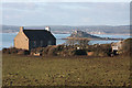
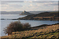
Photos of Perranuthnoe


Area Information
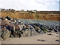
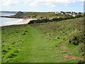
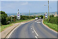
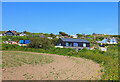
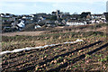
Perranuthnoe is a civil parish situated on the east side of Mount's Bay, positioned between Marazion and Prussia Cove. The parish covers an area of 4.9 square kilometres and includes several settlements such as Goldsithney and Perran Downs. You will find part of Rosudgeon within the boundary, along with Perranuthnoe itself. The population stood at 2,184 according to the 2011 census, indicating a small, contained community rather than a sprawling urban centre. This village lies on the A394 Penzance to Helston road, offering direct road access to nearby towns while maintaining a rural character. Living in Perranuthnoe means you are close to significant historical landmarks, including Saint Piran and Saint Michael's Church. The area also features Perranuthnoe Beach, which comprises large sand and pebble deposits suitable for walking and recreation. Local history reveals a past driven by farming and fishing, with notable mining activities occurring at sites such as Tregurtha Downs mine and Wheal Charlotte. Today, you can visit St Pirans Hall, which serves as the local town hall, or enjoy refreshments at The Greeb and the Crown Inn pub. The community centre, known as The Church Room, provides a focal point for local activities. Whether you are looking at homes in Perranuthnoe for their location or their proximity to Porthgoon, the area offers a distinct southwest Cornwall lifestyle. You are surrounded by natural beauty, yet practical access remains straightforward via the main coastal route. This parish combines rural tranquillity with essential amenities, making it a practical choice for those seeking a grounded life in the county.
- Area Type
- Parish
- Area Size
- 4.9 km²
- Population
- Not available
- Population Density
- Not available
Demographics
The community in Perranuthnoe displays a clear demographic profile that reflects its character as a smaller settlement. The median age of residents is 70 years, suggesting a population skewed towards older adults. You will find very few families with young children residing in the homes in Perranuthnoe compared to other Cornish coastal villages. Home ownership stands at 69% of total households, meaning nearly two out of three residents own their property outright or with a mortgage. The remaining 31% of households either rent privately or live in other accommodation types. Accommodation data for the parish shows a total composition that does not reveal a predominant single accommodation type in the raw figures provided, so the focus remains on ownership and age. The most common age range data is listed as 'Age: Total', which indicates a broad distribution but confirmed by the median age of 70. There is no specific breakdown for predominant ethnic groups or religious affiliations available in the current data, so discussions on diversity remain limited to general observations. Safety scores from the area assessment contribute to the community feel, with a crime risk level rated as a pass, yielding a safety score of 83 out of 100. This low crime risk reinforces the stability often sought by the older demographic living in the parish. Living in Perranuthnoe offers a quiet environment where the majority of your neighbours are likely to be retirees or long-term residents.
Household Size
Accommodation Type
Tenure
Ethnic Group
Religion
Household Composition
Age
Household Deprivation
NS-SEC
Explore more demographic insights in this area
Go to Demographics tabPlanning
Planning Constraints
- Flood RiskPremium
- Ramsar Wetland SitesPremium
- Area of Outstanding Natural BeautyPremium
- Protected Nature ReservePremium
- Protected WoodlandPremium
- Crime RiskPremium