Area Overview for OX7 6XN
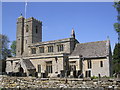
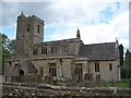
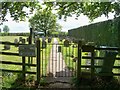
Photos of OX7 6XN
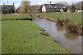
![Footpath to Gawcombe [1] in OX7 6XN](https://images.propbar.co.uk/images/geograph/19/16/1916079_120.jpg)
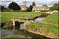
![Footpath to Bould [1] in OX7 6XN](https://images.propbar.co.uk/images/geograph/19/31/1931172_120.jpg)
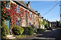
![Footpath to Bould [2] in OX7 6XN](https://images.propbar.co.uk/images/geograph/19/31/1931179_120.jpg)
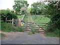
86 photos from this area
Area Information
Key information about the OX7 6XN including its size, population, and administrative classification.
- Area Type
- Postcode
- Area Size
- 2.9 hectares
- Population
- 1301
- Population Density
- 37 people/km²
House Prices in OX7 6XN
28
Properties
£300,334
Average Sold Price
£131,000
Lowest Price
£487,000
Highest Price
Showing 28 properties
| Address | Type | Beds | Baths | Last Sale Price | Last Sale Date | |
|---|---|---|---|---|---|---|
| 14 Jackson Road, Bledington, OX7 6XN | Bungalow | 2 | 1 | £487,000 | Dec 2025 | |
| 10 Jackson Road, Bledington, OX7 6XN | Semi-detached | 3 | - | £390,000 | Jul 2022 | |
| 20 Jackson Road, Bledington, OX7 6XN | Bungalow | 3 | 1 | £420,000 | Aug 2021 | |
| 27 Jackson Road, Bledington, OX7 6XN | Bungalow | - | - | £373,000 | Jun 2021 | |
| 24 Jackson Road, Bledington, OX7 6XN | Bungalow | 4 | 2 | £440,000 | Aug 2019 | |
| 18 Jackson Road, Bledington, OX7 6XN | Bungalow | - | - | £465,000 | Jul 2019 | |
| 7 Jackson Road, Bledington, OX7 6XN | Bungalow | - | - | £300,003 | Nov 2018 | |
| 3 Jackson Road, Bledington, OX7 6XN | Bungalow | 3 | - | £254,400 | Aug 2017 | |
| 26 Jackson Road, Bledington, OX7 6XN | Bungalow | 2 | - | £310,500 | May 2016 | |
| 16 Jackson Road, Bledington, OX7 6XN | Semi-detached | 2 | - | £245,000 | Aug 2015 |
Page 1 of 3
Energy Efficiency in OX7 6XN
Amenities
Schools
| Rank | School | Type | Entry gender | Ages |
|---|
Explore more schools in this area
Go to Schools tabDemographics
Household Size
Two person
most common
Accommodation Type
Houses
most common
Tenure
71
majority
Ethnic Group
White
most common
Religion
N/A
most common
Household Composition
N/A
most common
Age
47
median
Adults (30-64 years)
most common
Household Deprivation
N/A
with no deprivation
NS-SEC
42
in Lower managerial occupations
Explore more demographic insights in this area
Go to Demographics tabPlanning
Planning Constraints
- Flood RiskPremium
- Ramsar Wetland SitesPremium
- Area of Outstanding Natural BeautyPremium
- Protected Nature ReservePremium
- Protected WoodlandPremium