Area Overview for NP16 7PF
Photos of NP16 7PF
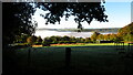
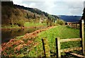

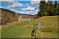
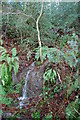
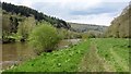
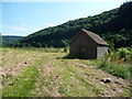
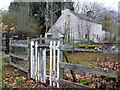
20 photos from this area
Area Information
Key information about the NP16 7PF including its size, population, and administrative classification.
- Area Type
- Postcode
- Area Size
- 29.7 hectares
- Population
- 1670
- Population Density
- 86 people/km²
House Prices in NP16 7PF
11
Properties
£507,331
Average Sold Price
£313,000
Lowest Price
£790,000
Highest Price
Showing 11 properties
| Address | Type | Beds | Baths | Last Sale Price | Last Sale Date | |
|---|---|---|---|---|---|---|
| The Hazels, Underhill, Brockweir, NP16 7PF | house | - | - | £490,000 | Nov 2024 | |
| Wye Valley Cottage, Underhill, Brockweir, NP16 7PF | Detached | 4 | 1 | £550,000 | Nov 2019 | |
| Rosewell, Underhill, Brockweir, NP16 7PF | Detached | 3 | 2 | £608,320 | Aug 2019 | |
| Acacia, Underhill, Brockweir, NP16 7PF | house | - | - | £475,000 | Dec 2015 | |
| Landfall, Road From Birch Hill Road To Junction With Hilgay Road, The Common, Brockweir, NP16 7PF | Bungalow | 4 | 2 | £325,000 | Nov 2014 | |
| Downfield, Road From Junction At Hill Farm To Yew Green Farm, The Common, Brockweir, NP16 7PF | Detached | 4 | - | £790,000 | Jan 2012 | |
| Vine Cottage, Underhill, Brockweir, NP16 7PF | Detached | 4 | 2 | £313,000 | Jun 2010 | |
| Woodcot, Road From Junction At Hill Farm To Yew Green Farm, The Common, Brockweir, NP16 7PF | house | 4 | 1 | - | - | |
| Brook Cottage, Underhill, Brockweir, NP16 7PF | Detached | - | - | - | - | |
| The Stable, Brook Cottage, Underhill, Brockweir, NP16 7PF | Detached | - | - | - | - |
Page 1 of 2
Energy Efficiency in NP16 7PF
Amenities
Schools
| Rank | School | Type | Entry gender | Ages |
|---|
Explore more schools in this area
Go to Schools tabDemographics
Household Size
Two person
most common
Accommodation Type
Houses
most common
Tenure
85
majority
Ethnic Group
White
most common
Religion
N/A
most common
Household Composition
N/A
most common
Age
47
median
Adults (30-64 years)
most common
Household Deprivation
N/A
with no deprivation
NS-SEC
43
in Lower managerial occupations
Explore more demographic insights in this area
Go to Demographics tabPlanning
Planning Constraints
- Flood RiskPremium
- Ramsar Wetland SitesPremium
- Protected Nature ReservePremium
- Protected WoodlandPremium