Area Overview for NP16 7JQ
Photos of NP16 7JQ
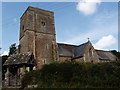
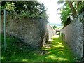
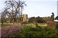
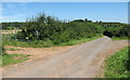
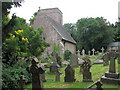
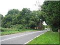
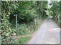
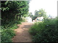
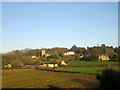
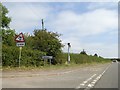

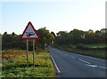
104 photos from this area
Area Information
Key information about the NP16 7JQ including its size, population, and administrative classification.
- Area Type
- Postcode
- Area Size
- 28.0 hectares
- Population
- 1200
- Population Density
- 57 people/km²
House Prices in NP16 7JQ
14
Properties
£797,650
Average Sold Price
£130,000
Lowest Price
£4,100,000
Highest Price
Showing 14 properties
| Address | Type | Beds | Baths | Last Sale Price | Last Sale Date | |
|---|---|---|---|---|---|---|
| Tidenham Manor, Road From A 48 To Cross Hill, Tidenham, NP16 7JQ | Detached | 6 | 6 | £4,100,000 | Apr 2023 | |
| Homer House, Road From A 48 To Cross Hill, Tidenham, NP16 7JQ | Detached | 4 | 1 | £750,000 | Sep 2021 | |
| Church Cottage, Road From Junction At The Brambles To Church Cottage, Tidenham, NP16 7JQ | house | - | - | £450,000 | Sep 2021 | |
| The School House, Road From A 48 To Cross Hill, Tidenham, NP16 7JQ | Semi-detached | 3 | - | £430,000 | Jun 2019 | |
| Roseland, Road From A 48 To Cross Hill, Tidenham, NP16 7JQ | Detached | 5 | 3 | £850,000 | Aug 2016 | |
| White Cellar Cottage, Road From A 48 To Cross Hill, Tidenham, NP16 7JQ | Cottage | 5 | 1 | £407,000 | Aug 2016 | |
| The Brambles, Road From A 48 To Cross Hill, Tidenham, NP16 7JQ | house | - | - | £485,000 | Jun 2013 | |
| Tidenham House Lodge, Road From A 48 To Cross Hill, Tidenham, NP16 7JQ | Detached | - | - | £130,000 | Aug 2001 | |
| Spring Cottage, Road From A 48 To Cross Hill, Tidenham, NP16 7JQ | Cottage | 3 | - | £160,000 | Aug 1997 | |
| Chasecroft, Road From A 48 To Cross Hill, Tidenham, NP16 7JQ | house | - | - | £214,500 | Jun 1995 |
Page 1 of 2
Energy Efficiency in NP16 7JQ
Amenities
Schools
| Rank | School | Type | Entry gender | Ages |
|---|
Explore more schools in this area
Go to Schools tabDemographics
Household Size
Two person
most common
Accommodation Type
Houses
most common
Tenure
87
majority
Ethnic Group
White
most common
Religion
N/A
most common
Household Composition
N/A
most common
Age
47
median
Adults (30-64 years)
most common
Household Deprivation
N/A
with no deprivation
NS-SEC
48
in Lower managerial occupations
Explore more demographic insights in this area
Go to Demographics tabPlanning
Planning Constraints
- Flood RiskPremium
- Ramsar Wetland SitesPremium
- Area of Outstanding Natural BeautyPremium
- Protected Nature ReservePremium
- Protected WoodlandPremium